
Large-scale features of functional significance
What is it:
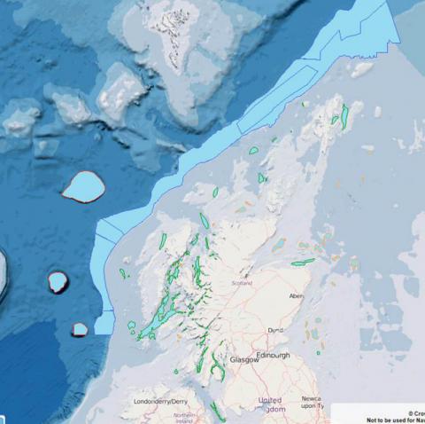
The layers include:
- The continental slope - a geological feature which divides the shelf sea and deep ocean ecosystem. In Scotland, the continental slope comprises two distinct regions; that to the north of the Wyville-Thomson ridge (the Faroe-Shetland Channel slope) and that to the south of the Wyville-Thomson ridge (the Hebridean slope).
- Seamounts are undersea geological structures at least 100 m high that do not reach the sea surface. They are generally conical, elliptical or elongated in shape, and usually of volcanic origin and/ or associated with geological faults and magma production hotspots. There are three seamounts in Scottish waters, all of which fall within the Rockall Trough to the far west of Scotland. These are Rosemary Bank, Anton Dohrn and the Hebrides Terrace.
- Shelf banks and mounds are formed by the action of strong currents on mobile sediments (usually coarse sands and gravels) and rise with a slope greater than 2% from the seafloor. Shelf banks and mounds occur off all Scottish coasts e.g. the Shiant East Bank in the Minch; Nun, Whiten Head and Stormy Banks off the north coast; Dutch and Forty Mile Banks to the east of Shetland; the Smith Bank in the outer Moray Firth; and the Marr, Montrose, Berwick, and Scalp Banks, together with the Wee Bankie, in the outer Firth of Forth.
- Shelf deeps are enclosed topographic depressions on the seabed, in most cases created by glacial erosion during periods of lower sea level. Several types of deeps have been recognised in Scottish waters, including channels, troughs, valleys and canyons. Shelf deeps are recorded from the north Irish Sea (e.g. Beauforts Dyke and the Mull of Galloway Canyons), around the west coast (e.g. Stanton and Malin Deeps, Gulf of Corryvreckan, Inner Sound of Raasay), to Shetland, and south through the Fladen Deeps in the northern North Sea to the Southern Trench in the Moray Firth, the Buchan Deep off Aberdeenshire and the Devil’s Hole, about 200km east of Dundee.
Data originators:
This information page is part of the theme:
Large-scale features of functional significance © Marine Scotland