
OSPAR - Discharge Monitoring Points & Sampling Regions
What is it:
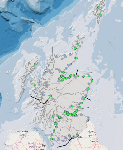
The four associated layers show:
- location of OSPAR Riverine Inputs monitoring points;
- location of OSPAR Direct Discharges monitoring points;
- OSPAR sampling regions for the monitoring points;
- sea divisions of the sampling regions.
Updated graphs (as found in Scotland’s Marine Atlas) can be accessed in the 'Data Sources' tab at the bottom of the page.
Links to Scotland's Marine Atlas:
Data originators:
This information page is part of the theme:
OSPAR monitoring points and sampling regions © OSPAR & SEPA
Links and Resources
| Type |
Link Title |
External Link |
|---|---|---|
| Datasets | OSPAR - Data - RID | odims.ospar.org |
| Type | Title | External link |
|---|---|---|
| Web link | Marine Scotland - Science and Data | www.gov.scot |