Pentland Firth and Orkney Waters Marine Spatial Plan - March 2016
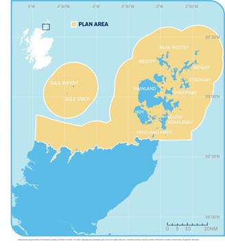
The Pentland Firth and Orkney Waters was chosen to pilot the development of a marine spatial plan to support sustainable management of the area’s seas. This pilot plan aims to put in place a planning policy framework in advance of statutory regional marine planning to support sustainable decision making on marine use and management. For detailed information please visit the Pentland Firth & Orkney Waters MSP pages where you can view background information and the the planning process.
The final plan can be downloaded from the link in the data sources table below. It contains details of the data originators for all the individual data sets used for the maps. It is not possible to list all the originators here. As the plan is a snapshot in time, more up to date data may be available on MS Maps NMPi along with data originator details.
Supporting maps, created for the plan, are available to view on NMPi and can be selected from the maps table below.