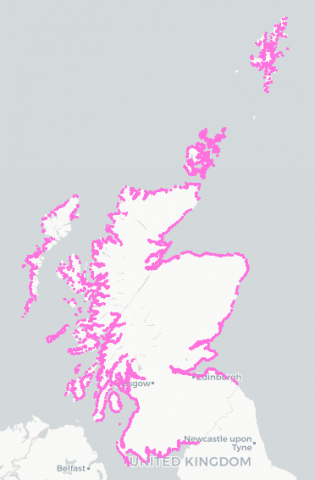
National Coastal Change Assessment (NCCA) 2017
The National Coastal Change Assessment (NCCA) aims to establish historic coastal change by extracting the georectified coastline position from OS 2nd Edition Country Series maps (1892-1905) and to then compare it to both the 1970s and current coastal position (updated by LiDAR datasets where available) in order to estimate past erosion/accretion rates.
Using the historic coastal change rates the coastline position can then be projected into the future, albeit mediated by a Coastal Erosion Susceptibility Model (CESM) whose function is to limit erosion to areas where the hinterland is susceptible to erosion.
MS Maps NMPI shows 5 layers:
- Dynamic Coast - Scotland MHWS Modern
- Dynamic Coast - Scotland MHWS 1970
- Dynamic Coast - Scotland Change 1970 modern
- Dynamic Coast - Future Look 2050 Public
- Dynamic Coast - Future Look 2100 Public
Links to the full NCCA reports and data sources can be found in the tabs below. There are further data layers available in a Web Map Service feed that users can add to MS Maps NMPi. The url is listed on the MSI Maps> Map Services page.
The layers are best viewed at 1:433,434 or better as they are slow to draw.

Links and Resources
| Map Type |
Click title for metadata and licence information |
Date of data | View Map |
|---|---|---|---|
| Map Layers (NMPi) | Dynamic Coast - Scotland MHWS Modern (SNH WMS) | 2001-01-01 to 2016-12-31 | Access this map on NMPi |
| Map Layers (NMPi) | Dynamic Coast - Scotland MHWS 1970 (SNH WMS) | 1956-01-01 to 1995-12-31 | Access this map on NMPi |
| Map Layers (NMPi) | Dynamic Coast - Future Look 2100 Public (SNH WMS) | 2100-01-01 | Access this map on NMPi |
| Map Layers (NMPi) | Dynamic Coast - Future Look 2050 Public (SNH WMS) | 2050-01-01 | Access this map on NMPi |

