
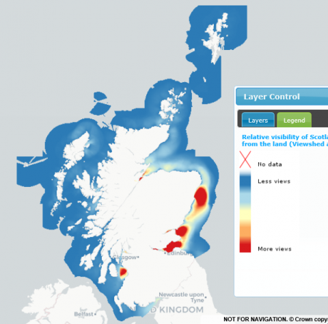
Relative visibility of Scotland’s coastal marine areas from the land (Viewshed analysis)
What is it:
The Viewshed tool in ArcGIS has been used to develop a GIS layer, with approximately 30 m resolution, showing the visibility of locations in the sea in terms of the number of buildings with a view of any given location i.e. the higher the number the more buildings that can see that marine location from the land.
The analysis is featured in the paper O’Higgins. et al. (2018) ‘Many Points of View : Visibility Mapping for Marine Spatial’, 13, pp. 302–314. doi: 10.2902/1725-0463.2018.13.art18. (see link under ‘Additional Information’ tab below).
Links to Scotland's Marine Atlas:
Data originators:
This information page is part of the theme:
Relative visibility of Scotland’s coastal marine areas from the land (Viewshed analysis) © MaREI Centre for Marine and Renewable Energy, University College Cork