
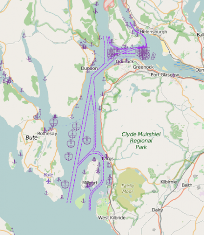
Anchor berths, anchorage areas and navigation channels (fairways)
What is it:
The layers show:
- navigational channels, fairways and buoyed areas around / within ports that are used for the purposes of guiding shipping movements. Ships may also be seen outwith these areas if there is sufficient water depth.
- anchorages that have been designated and where a harbour / port authority may request a vessel to anchor. A vessel may also anchor anywhere as directed by a harbour / port authority when within their jurisdiction.
For the main ports, Marine Scotland has confirmed the data with the relevant harbour / port authority.
Date of Data: 2015
Links to Scotland's Marine Atlas:
Data originators:
This information page is part of the theme:
Anchor berths and anchorage areas navigational channels (recommended routes and fairways) October 2014 © OceanWise