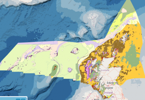
Broad-Scale Predictive Habitat Map - EUSeaMap2 - EUNIS
What is it:
This layer is a predictive European Nature Information System (EUNIS) seabed habitat map clipped to the Scottish zone, with an extension to continental shelf limits west of Rockall. The map follows the EUNIS 2007-11 classification system where it is appropriate.
It is an output of the 2016 (updated 2019) EUSeaMap broad-scale predictive model, produced by EMODnet Seabed Habitats. The map was produced using a "top-down" modelling approach using classified habitat descriptors (Biological zone, Energy class, Oxygen regime, Salinity regime, Seabed Substrate and Riverine input) to determine a final output habitat.
Links to Scotland's Marine Atlas:
Data originators:
This information page is part of the theme:

Predicted seabed habitat © EMODNet
Links and Resources
| Type |
Link Title |
External Link |
|---|---|---|
| Data Portals, Web link | EMODnet Seabed Habitats | www.emodnet-seabedhabitats.eu |

