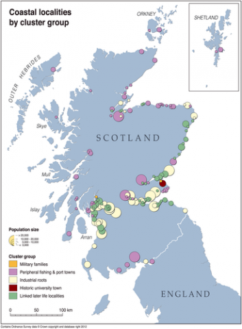
Scottish Coastal Localities Typology (2016)
A multi-level coastal typology study was developed in 2016, by joint ESRC and Scottish Government doctoral student Dr Paula Duffy of the Marine and coastal environment team at the University of St Andrews. The study investigated 2011 census data (see also MS Maps NMPi ‘Human Population - Census 2011 / Mid-2012 Population Density Estimates for Localities in Scotland (NRS)’) to create a socio-economic and demographic profile of characteristics in 2011. A second level of the typology incorporates measures for social composition and change over time in population size, age profile and social variables since the previous census in 2001.
A two-stage cluster analysis of the data (see link in ‘Data Sources’ tab for paper detailing the methodology) was undertaken for coastal localities (defined as within 2 kilometres of the coast) with populations of greater than 1,000 (for reasons of confidentiality). This 1,000 threshold explains why many smaller coastal communities do not feature on the maps.
The study has created 6 maps, hosted on MS Maps NMPi:
- Coastal localities by level 1 cluster group
- Military families
- Peripheral fishing and port towns
- Industrial roots
- Historic university town
- Linked later life localities


