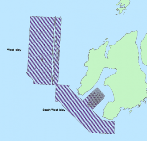
West Islay Bathymetry 2012 and 2013
A bathymetric survey of an area identified for renewable development off the south west coast of Islay was carried out by Marine Scotland Science in 2012. This data has been corrected to chart datum and cleaned at 2m resolution. This data was collected and processed in WGS1984 UTM29N. The data can be viewed in 3D using the CSAR file in Caris Easy View. A 2m resolution resolution BAG format file, ArcGrid ASCII and raster file have also been made available. This data was collected and processed in WGS1984 UTM29N.
A second site off the west coast of Islay of interest for renewable developments, was surveyed by Marine Scotland Science in 2013. This data was collected by Marine Scotland Science and processed by the British Geological Survey (BGS). It has been cleaned and corrected to WGS84 using the UTM29N projection. The bathymetry can be viewed in 3D with the SD file using iview4D. BAG format file, ArcGrid ASCII and raster file have also been made available for viewing in 2D. The artificial errors evident towards the east of the survey area were due to a poor signal with the Applanix system.
The data has been processed further using ESRI ArcGIS and hillshade, aspect, slope and rugosity products have been produced. These are included in the packages available below.

Links and Resources
| Map Type |
Click title for metadata and licence information |
Date of data | View Map |
|---|---|---|---|
| Map Layers (NMPi) | Marine Directorate Survey Areas | 2010-07-21 | Access this map on NMPi |

