Bathymetry
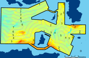
Bathymetry is the study of ocean floor depth and elevation. Bathymetric charts and maps provide depth information, sometimes with additional navigational information and/or terrain relief effects.
Bathymetry surveys carried out by Marine Scotland are collected using a multi-beam echosounder (Reson 7125). This system provides detailed information on the seabed bathymetry. The system is georeferenced using an Applanix POS MV(tm) and Fugro STARFIX DGPS. Daily water column profiles are recorded using a sound velocity probe. Tide gauges (RBR DR-1050) are also deployed for the duration of the survey to enable tidal corrections. Survey transect lines are spaced to ensure >50% overlap between adjacent lines for most of the areas to maximise the coverage of the area surveyed. Typically, 8 knots was maintained in open water for 60 m or less however, sites greater than 60 m were surveyed at speeds of 4 knots.
The UK Hydrographic Office (UKHO) are the UK data archive centre for bathymetry data, but some resources are listed below that might be of use.
- The UKHO offer survey data from UKHO marine data portal under open licence. This tends to cover inshore areas of the UK, and includes data surveyed by Marine Scotland.
- OceanWise offer a 1 arcsecond digital elevation model under commercial licence. This covers UK waters. Other suppliers might be available.
- EMODnet offer a 1/16 arcminute (3.75 arcseconds) digital elevation model for free, under certain licence conditions. This data covers the NE Atlantic region. They also have an interactive map which can display contours.
- GEBCO offer a 1/4 arcminute (15 arcseconds) digital elevation model for free, under certain licence conditions. This data covers the globe.
The British Geological Survey (BGS) are the UK data archive centre for geophysical seabed data and may be offer to more advice on submerged land bridges and the Storegga landslide.
Note that Scottish Government has a contract with OceanWise for the supply of bathymetry data under licence.
View Notice - Public Contracts Scotland
Bathymetry (OceanWise Marine Themes DEM) | Marine Scotland Information

| Title |
Updated date |
|---|---|
| Base and background layers | 28/09/2023 |
| West Islay Bathymetry 2012 and 2013 | 16/04/2019 |
| Pentland Firth Bathymetry 2009 | 16/04/2019 |
| Shetland Bathymetry 2012 | 16/04/2019 |
| West of Lewis Bathymetry 2010 and 2011 | 16/04/2019 |
| UK Civil Hydrography Programme - Orkney Bathymetry | 23/10/2018 |
| Rockall Bathymetry 2011 and 2012 | 22/09/2017 |
| UK Civil Hydrography Programme - Outer Hebrides | 14/03/2017 |
| Marine Scotland Seabed videos and Images | 10/10/2016 |
| Tiree Bathymetry 2012 | 07/06/2016 |
| Armadale Bathymetry 2011 | 07/06/2016 |
| Farr Point Bathymetry 2014 | 07/06/2016 |
| Bathymetry Geodatabases to Assist in Wave and Tidal Energy Site Selection | 24/03/2016 |

