

Background
Scotland’s position at the edge of the north-west European continental shelf has a huge influence on its coasts and seas. The marine environment has been shaped by wind, water, and ice over thousands of years, creating the environment that supports productive and abundant marine life.
The meeting and mixing of nutrient-rich waters provides the perfect environment for sea life to thrive. Scotland is of international importance for marine biodiversity providing the ideal environment for both overwintering and breeding birds, marine mammals and fish, as well as for the invertebrates and algae that are found on and within the sea bed.
Marine Protected Areas (MPAs) have an important role to play in conserving the seas. They enable the focused protection of habitats and species considered important for the functioning of the marine ecosystem. MPAs facilitate an increase in ecosystem resilience and recovery of habitats and species where required.
The MPA network (Table 1 and Figure 1) consists of nature conservation sites designated under various legislative frameworks. These are underpinned by the Marine (Scotland) Act 2010, which provides the powers to designate MPAs within inshore waters (within 12 nautical miles), and the UK Marine and Coastal Access Act 2009 which gives powers for offshore waters. The network also includes other areas which deliver nature conservation benefits, known as Other Area Based Measures (OABMs). Sites are also designated to protect the historic environment and for demonstration and research purposes.
This assessment is based on the Marine Protected Area Network - 2018 Report to the Scottish Parliament (Scottish Government, 2018).
|
Type
|
Number
|
Number
|
|
MPAs for nature conservation
|
|
217
|
|
Marine Protected Area (MPA)
|
31
|
|
|
Special Area of Conservation (SAC)
|
58
|
|
|
Special Protection Area (SPA)
|
47
|
|
|
Site of Special Scientific Interest (SSSI)
|
65
|
|
|
Ramsar
|
16
|
|
|
MPAs for other purposes
|
|
9
|
|
Demonstration and Research MPA
|
1
|
|
|
Historic MPA
|
8
|
|
|
Other area based measures
|
|
5
|
|
Total
|
|
231
|
.")
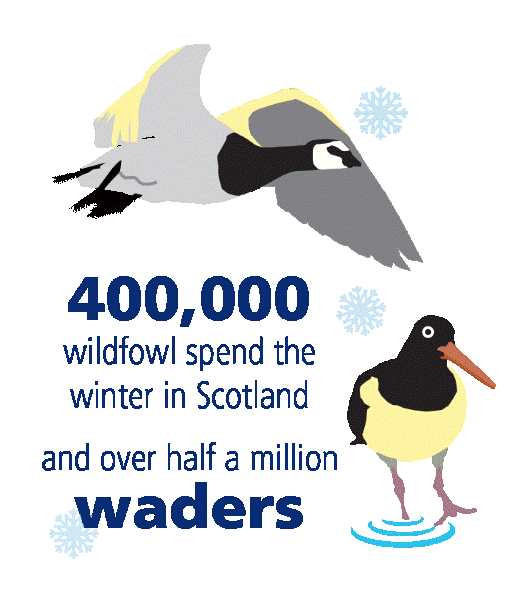
Coastal habitats support a wealth of plants and animals. Saline lagoons and estuarine habitats mark the transition from freshwater to seawater, with specialist plants and animals able to cope with the dramatic changes in salinity and temperature. Many bird species come to these areas as a safe haven for the winter months.

The complex and variable coastline is mirrored by a diversity of productive habitat forming species such as kelps, seagrasses, blue mussels and maerl. These habitats support a rich diversity of other species and also capture and store carbon.
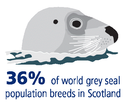
Seals can be found foraging in coastal waters, or hauled out on rocks or sandy beaches all around the coast. The Moray Firth on the east coast is home to the world’s most northerly population of bottlenose dolphin, whilst the Firth of Forth is globally important for breeding seabirds.
The continental shelf is dominated by large sediment plains made up of sands, gravels, and burrowed mud. These habitats are home to a wide range of species, such as the ocean quahog which is capable of living for hundreds of years.
Sandeels, a key prey species for seabirds and marine mammals, are found on sandbanks throughout the seas.
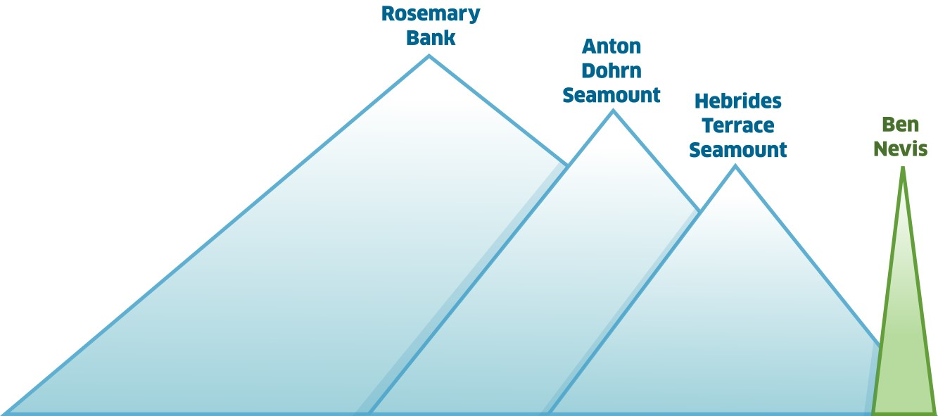
Beyond the continental shelf lies the deep sea. This vast area is divided by the Wyville-Thomson ridge which results in differences in the marine life on either side. To the north the Faroe-Shetland Channel is dominated by cold Arctic waters. To the south the Rockall Trough is dominated by warmer Atlantic waters and has three underwater mountains, known as seamounts, each of which is taller than Ben Nevis.
Looking after the seas requires a range of different management approaches. This includes marine planning and licensing together with various different statutory and voluntary codes and good practice. Doing so is vital to ensuring that society can continue to derive the many natural benefits that our seas provide.
MPAs have an important role to play in conserving the seas. They enable the focused protection of habitats and species which are essential to the marine ecosystem. This facilitates an increase in ecosystem resilience and recovery of habitats and species where required.
The Scottish MPA Monitoring Strategy (Scottish Government, 2017) sets out the approach to monitoring the MPA network. Currently establishing condition and status baselines of MPAs is the priority, however monitoring also covers the pressures exerted on MPA features. Studies to explore the effectiveness of new measures to restrict certain fisheries within sites (‘fisheries management measures’) are also underway. Historic Environment Scotland undertakes periodic monitoring work on Historic MPAs to maintain a register of survival and site condition. Seventy-seven MPAs were visited as part of monitoring surveys between 2012 and 2018 (Figure 2).

A preliminary assessment of progress towards conservation objectives of the MPAs, designated under the Marine Acts, is provided in the results extended section. Conservation objectives for each are outlined within designation orders and describe the aim of the MPA, normally whether it is to protect, prevent deterioration of, or contribute to the recovery of features. More comprehensive assessments of this progress are expected from 2024 onwards once repeat surveys have taken place.
MPA monitoring includes collaboration with other stakeholders and citizen science. For example, Historic Environment Scotland receives reports from diving clubs and archaeologists who help to monitor historic shipwreck sites. Promoting sustainable visitor access is essential, with the creation of a visitor trail on the Duart Point Historic MPA a positive example.
A larger monitoring collaboration is the project developed by Marine Scotland and Scottish Natural Heritage funded by the European Maritime and Fisheries Fund, which runs until the end of 2020. It is engaging the fishing industry in the surveying and monitoring of seabed habitats located within the Scottish MPA network and adjacent waters. The project has enabled improved understanding of marine habitats while working in partnership with the Scottish fishing industry.
The project has the following objectives:
- Develop and test robust underwater video cameras for seabed surveying and monitoring from fishing vessels;
- Undertake marine survey and monitoring work in partnership with fishers, to assess the condition of selected habitats and species and assess the effectiveness of new fisheries management measures;
- Analyse survey data to meet reporting and assessment obligations in relation to the protection and restoration of marine biodiversity;
- Increase stakeholder participation and engagement through on-going dialogue and communication;
- Ensure effective dissemination of the project's outputs through outreach and knowledge exchange.
These objectives are being delivered through several key work packages encompassing: marine surveys, monitoring equipment design and development, data standards and management, and outreach and knowledge exchange. The marine surveys have now all been completed, and the analysis of survey data is currently being undertaken.
Surveys were undertaken by the project to meet a number of data gathering needs for the MPA network by using the drop-down video camera (developed under the project) to record footage within and outside MPAs to monitor presence and quality of seabed habitats. Sites visited include Wester Ross MPA, Small Isles MPA, South Arran MPA, and sites around Shetland and Orkney. Other surveys undertaken through the project include deployment of equipment to monitor juvenile fish abundance, dolphin and porpoise presence, and common skate movement.
Results
The Scottish MPA network has changed considerably since 2012, and now better reflects the variety of life found in the seas. In total 231 MPAs cover 22% of the seas, which represents a considerable step forward. Figure 1 shows all MPAs and area-based measures which contribute to the MPA network.
Since 2012, a total of 42 new MPAs have been designated to protect features including, black guillemot, flame shell beds, common skate, seamounts, warships and merchant trading vessels and two sites have been extended to better protect seabed habitats.
In Scottish waters there are currently 217 MPAs for nature conservation purposes covering an area of about 108,000 km2, approximately 18% of the sea area adjacent to Scotland. It represents 52% of overall UK Network.
The Marine Acts, which underpin the MPA network, include three conditions that it must achieve:
- Contribute to the conservation or improvement of the marine environment.
- Represent the range of features present in the UK marine area.
- Reflect that the conservation of a feature may require the designation of more than one MPA.
These conditions have mostly been achieved with the network including all widely distributed habitats and species in several sites. Possible MPAs for mobile species, currently being progressed, will help improve the ecological coherence of the network.
These sites also contribute to spatial protection measures under the EU Marine Strategy Framework Directive (MSFD) and the OSPAR MPA network in the North-East Atlantic and address commitments in relation to the Convention on Biological Diversity. In spatial terms Scotland’s seas make up a relatively small proportion of the OSPAR maritime area. Although no regional based target has been set for MPA coverage the Scottish MPA network covers significant parts of each OSPAR region (Table 2).
|
OSPAR Region
|
Percentage of area within Scottish waters covered by MPAs
|
|
Arctic Waters (I)
|
73%
|
|
Greater North Sea (II)
|
12%
|
|
Celtic Seas (III)
|
25%
|
|
Wider Atlantic (V)
|
14%
|
The MPA network covers a diverse array of marine habitats, wildlife, geology, landforms and historic shipwrecks. Conservation objectives have been agreed for the MPAs and describe what the sites are aiming to achieve. Management advice for each site is used to determine whether new activities or development can be consented, as soon as an MPA is designated. It is the responsibility of all public authorities to ensure that the conservation objectives of MPAs are not hindered. This applies equally to their own functions as well as when determining whether to consent activities they regulate.
Progress has been made since 2012 in implementing fisheries management measures in MPAs, which due to their differing management regime do not come into effect immediately after designation of a MPA. There are now 27 MPAs that have specific fisheries measures in place and measures for a further 39 are currently being developed in partnership with the fishing industry, other stakeholders and other European countries.
The Marine Protected Area Network - 2018 Report to the Scottish Parliament, (Scottish Government, 2018) includes a range information on the MPA network.
Since 2012, 42 new sites have been added to the MPA Network:
- 29 MPAs designated or amended under the Marine (Scotland) Act 2010, including:
- 18 sites for Nature Conservation purposes covering 3,847 km2 and two sites amended;
- one site for Demonstration and Research purposes covering 157 km2; and
- eight for Historic purposes covering 0.75 km2.
- 13 MPAs designated under the Marine and Coastal Access Act 2009 covering 57,668 km2.
- Two SACs designated under the Conservation (Natural Habitats, &c.) Regulations 1994 covering 13,927 km2.
- Two SACs amended under the Conservation of Offshore Marine Habitats and Species Regulations 2017 covering 18 km2 (size increased by a total of 9.6 km2).
This is in addition to the 32 SACs, SPAs, SSSIs and Ramsar sites designated before 2012 which now form part of the MPA Network. Some changes have been made in how sites in the MPA network are counted caused by updating the counting methodology, clarifying overlap with the marine area, and in the case of Ramsar sites completing assessment of their potential inclusion. This does not affect the protection status of any site.
There are also five sites for other area-based measures contributing to the MPA network. These sites cover 41,750 km2 and are in place for the conservation of vulnerable marine ecosystems and fish species. Although not specifically created for nature conservation purposes these sites contribute to the protection of marine biodiversity. They support progress towards delivering Good Environmental Status under the UK Marine Strategy, particularly in terms of maintaining or improving biodiversity and seafloor integrity.
Table a provides an overview of the total area coverage of nature conservation sites in Scottish waters. Full details of the number and size of MPAs, and the contribution of Scottish MPAs to the OSPAR and other networks, can be found in the Report to Parliament (Scottish Government, 2018).
|
Region
|
Region area (Km2)
|
MPA area (Km2)
|
MPA coverage
|
|
Inshore
|
90,407
|
22,022
|
24.4%
|
|
Offshore
|
528,337
|
86,772
|
16.4%
|
|
Total
|
618,744
|
108,794
|
17.6%
|
The Marine Acts, which underpin the MPA network, include three conditions (see above). To meet these conditions many species and habitats are protected as features of multiple MPAs in each OSPAR Region of Scottish waters. Full details of the replication of marine species and habitats across the MPA Network can be found in the Report to Parliament (Scottish Government, 2018).
Conservation and management or preservation objectives have been agreed for the Scottish MPAs in the network. These objectives describe what the sites are trying to achieve and are used to determine whether new activities or development can be consented. In future the results of monitoring will help measure whether the objectives are being achieved. Details of the objectives for each MPA designated under the Marine Acts, along with details of progress towards achieving them, is provided in the Report to Parliament (Scottish Government, 2018). A summary of these assessments is provided in Table b below. Completion of objectives are rated as being;
- Yes – Specific fisheries measures are implement and other licensable activities are controlled through regulatory processes. Protected features are improving in condition or have achieved conservation objectives.
- Partial - Specific fisheries measures are in the process of being implemented and other licensable activities controlled through regulatory processes. Some protected features are improving in condition or have achieved conservation objectives. Others are not improving in condition or status is unknown.
- Unknown - It is uncertain if there is sufficient management in place to address identified threats or pressures. There is not sufficient data to determine if there is progress towards achieving the conservation objectives.
|
|
No. MPAs where measures in place
|
No. MPAs where COs have been achieved?
|
|
Yes
|
14
|
9
|
|
Partial
|
17
|
15
|
|
Unknown
|
0
|
7
|
Full details of the progress towards objectives in Historic and Demonstration and Research MPAs can be found in the Report to Parliament (Scottish Government, 2018).
For each site consideration of the need for specific management, over and above the general protective provisions provided by the Marine Acts, is undertaken. A total of seven Marine Conservation Orders, under section 85 of the Marine (Scotland) Act 2010, have been implemented since 2012. Currently four remain in force.
Confidence assessment
There is high confidence in the methodology for the assessment. The monitoring methodology, as published in the MPA Monitoring Strategy, outlines the requirement to assess whether MPAs are meeting their objectives which can either be to ‘conserve’ or ‘restore’ the protected features of the site. Conservation objectives for individual sites can be found on NatureScot’s Sitelink.
There is medium confidence in the data. Not all the MPAs have been assessed within the assessment period therefore a full assessment of whether they are achieving their objectives is not currently possible.
Conclusion
Progress has been made in developing the Scottish MPA network which has increased in size significantly and now exceeds international targets. However, further work is required to complete the network, deliver any necessary management measures, and continue the monitoring programme.
To complete the network a number of actions are currently underway, including:
- Nature conservation proposals are being progressed for seabirds, waders and seaducks, basking shark, Risso’s dolphin and minke whale.
- Progressing assessment of historic wrecks - The Queen of Sweden wreck near Shetland, and the wartime history of Scapa Flow. A small number of other assessments may be anticipated as new discoveries come to light.
- Development of a Deep Sea Marine Reserve to safeguard marine life that is under threat in deeper waters across the North-east Atlantic.
To ensure the network is well-managed the following work is ongoing:
- Progressing further fisheries measures as required to achieve site objectives.
- Ensuring that Public Authorities get clear advice to inform their decision making where an MPA may be affected.
- Trialing innovative approaches to MPA management planning, working with local communities and other stakeholders to develop these.
- Continued implementation of the MPA monitoring strategy.
Knowledge gaps
As the MPA monitoring strategy follows a risk-based approach not all sites have been monitored since the last assessment. The ongoing monitoring programme will allow a more thorough assessment of whether individual MPAs are achieving their objectives by the time of the next report to parliament in 2024.
Status and trend assessment
It is not possible to undertake a traffic light or trend assessment on whether the ecological objectives of the MPA network have been met due to the lack of data points. However, the MPA monitoring strategy should allow for this by the time of the next assessment.
In terms of process the designation of the network and establishment of management measures is either achieved or on track to be achieved, apart from offshore fisheries management measures, which have been delayed by EU Exit. No trend assessment is possible.
This Legend block contains the key for the status and trend assessment, the confidence assessment and the assessment regions (SMRs and OMRs or other regions used). More information on the various regions used in SMA2020 is available on the Assessment processes and methods page.
Status and trend assessment
|
Status assessment
(for Clean and safe, Healthy and biologically diverse assessments)
|
Trend assessment
(for Clean and safe, Healthy and biologically diverse and Productive assessments)
|
||
|---|---|---|---|
 |
Many concerns |
No / little change |
|
 |
Some concerns |
Increasing |
|
 |
Few or no concerns |
Decreasing |
|
 |
Few or no concerns, but some local concerns |
No trend discernible |
|
 |
Few or no concerns, but many local concerns |
All trends | |
 |
Some concerns, but many local concerns |
||
 |
Lack of evidence / robust assessment criteria |
||
| Lack of regional evidence / robust assessment criteria, but no or few concerns for some local areas | |||
 |
Lack of regional evidence / robust assessment criteria, but some concerns for some local areas | ||
| Lack of regional evidence / robust assessment criteria, but many concerns for some local areas | |||
Confidence assessment
|
Symbol |
Confidence rating |
|---|---|
|
Low |
|
|
Medium |
|
|
High |

Assessment regions
 and the Scottish Offshore Marine Regions (OMRs, O1 – O10)")
Key: S1, Forth and Tay; S2, North East; S3, Moray Firth; S4 Orkney Islands, S5, Shetland Isles; S6, North Coast; S7, West Highlands; S8, Outer Hebrides; S9, Argyll; S10, Clyde; S11, Solway; O1, Long Forties, O2, Fladen and Moray Firth Offshore; O3, East Shetland Shelf; O4, North and West Shetland Shelf; O5, Faroe-Shetland Channel; O6, North Scotland Shelf; O7, Hebrides Shelf; O8, Bailey; O9, Rockall; O10, Hatton.
 Regions. These have been used as the assessment areas for hazardous substances.")
, Regions.")