Coast protection, flood defence and managed re-alingnment
What is it:
Three data layers show coastal:
- protection schemes built since 2000.
- flood defence schemes since 1961.
- managed re-alignment schemes.
The point data set shows the approximate location of the works rather than their full extent.
Links to Scotland's Marine Atlas:
Data originators:
This information page is part of the theme:

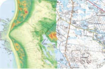
Digital elevation model from LiDAR super-imposed on Ordnance Survey map of southern South Uist © SNH
Links and Resources
Map Type |
Click title for metadata and licence information![]() |
Date of data | View Map |
---|---|---|---|
NMPi | Coastal Protection and Flood Defence - Coast protection schemes since 2000 | 2000-01-01 to 2013-02-14 | Access this map on NMPi |
NMPi | Coastal Protection and Flood Defence - Flood defence schemes since 1961 | 1961-01-01 to 2013-02-14 | Access this map on NMPi |
NMPi | Coastal Protection and Flood Defence - Managed re-alignment schemes | 2011-01-20 | Access this map on NMPi |
Type | Title | External link |
---|---|---|
Web link | Scottish Government - Flood Prevention Schemes | www.gov.scot |