Faroe-Shetland Channel
Location: Stations between Faroe and Shetland, north of Scottish mainland
Monitoring Period: 1893 - Present
What is collected?
- Temperature - 1-5 times/year
- Salinity - 1 - 5 times/year
Background
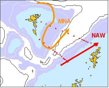
The data from offshore surveys are used to understand the circulation in Scottish waters. Particularly important are the water masses that pass through the Faroe-Shetland Channel to and from the Arctic, and those that exchange with the Northern North Sea.
Two lines of stations between Shetland and Faroes are called the Fair Isle - Munken Line (FIM - southernmost line) and the Nolso-Flugga Line (NOL - norternmost line) are regularly monitored for temperature and salinity to classify and characterise the water masses in the Faroe-Shetland Channel. The two main water masses are characterised and shown in the image.

Links and Resources
| Type |
Link Title |
External Link |
|---|---|---|
| Reports | ICES Report on Ocean Climate 2014 | ices.dk |

