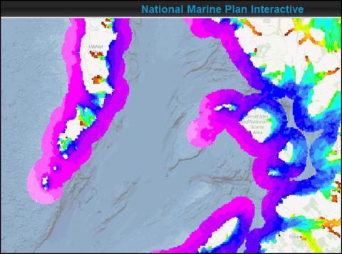
Wave exposure index
What is it:
Wave height is determined by the distance that winds blow over the surface of the ocean (known as the wave fetch). Longer fetch produces bigger waves, so wave fetch is a useful proxy for wave climate. The layer shows the sum of the wave fetch in 32 directions for points on a 200m grid.
The data are derived from a model that searches from each location for the nearest land in each direction. The wave exposure index is an accurate predictor of species with particular wave habitat requirements, such as the kelp known as ‘tangle’ found only in exposed conditions, and Egg wrack seaweed found only in wave shelter.
Date of Data: January 2012
Links to Scotland's Marine Atlas:
Data originators:
This information page is part of the theme:

Wave exposure index screen shot © Marine Scotland
Links and Resources
| Type |
Link Title |
External Link |
|---|---|---|
| Datasets | SAMS - Wave fetch model details | www.sams.ac.uk |

