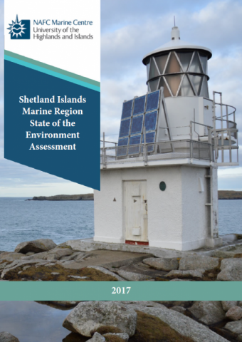
Shetland Islands Marine Region State of the Marine Environment Assessment

What is it: 

The Shetland Islands Marine Region State of the Marine Environment Assessment was published in 2017. It was developed by NAFC Marine Centre, on behalf of the Shetland Islands Marine Planning Partnership, with guidance from the Shetland Islands Marine Planning Partnership Advisory Group. The assessment provides a data baseline to support the development of a regional marine plan under the Marine Scotland Act (2010). Where this assessment findings differences with the national level assessment in Scotland’s Marine Atlas, these have been highlighted and explained.

Most maps from the assessment have been recreated on Marine Scotland Maps (NMPi) and can be viewed using the links in the Maps table below.

Map 2, maps 16 to 26 and map 34 were part of the assessment, but it wasn’t possible to make them available on NMPi because sharing the underlying spatial data to third parties was not permitted by the data owners. These maps can be viewed in the Shetland Islands Marine Region State of the Marine Environment Assessment, which can be downloaded from the Data Sources table below.
This information page is part of the theme: 
Shetland Islands Marine Region State of the Marine Environment Assessment, Copyright © NAFC Marine Centre UHI 2017

Links and Resources

Map Type Click title for metadata and licence informationsort descending Date of data View Map
Map Layers (NMPi) Map 39 - Informal recreation locations (Part 2/2) 2017-04-01 Access this map on NMPi
Map Layers (NMPi) Map 4 - Shellfish Protected Areas 2017-04-01 Access this map on NMPi
Map Layers (NMPi) Map 40 - Coastal archaeology (Part 1/3) 2017-04-01 Access this map on NMPi
Map Layers (NMPi) Map 40 - Coastal archaeology (Part 2/3) 2017-04-01 Access this map on NMPi
Map Layers (NMPi) Map 40 - Coastal archaeology (Part 3/3) 2017-04-01 Access this map on NMPi
Map Layers (NMPi) Map 41 - Submerged archaeology (Part 1/2) 2017-04-01 Access this map on NMPi
Map Layers (NMPi) Map 41 - Submerged archaeology (Part 2/2) 2017-04-01 Access this map on NMPi
Map Layers (NMPi) Map 42 - Tidal resource and licence locations (Part 1/2) 2017-04-01 Access this map on NMPi
Map Layers (NMPi) Map 42 - Tidal resource and licence locations (Part 2/2) 2017-04-01 Access this map on NMPi
Map Layers (NMPi) Map 43 - Wave resource 2017-04-01 Access this map on NMPi
Map Layers (NMPi) Map 44 - Oil and Gas infrastructure (Part 1/3) 2017-04-01 Access this map on NMPi
Map Layers (NMPi) Map 44 - Oil and Gas infrastructure (Part 2/3) 2017-04-01 Access this map on NMPi
Map Layers (NMPi) Map 44 - Oil and Gas infrastructure (Part 3/3) 2017-04-01 Access this map on NMPi
Map Layers (NMPi) Map 45 - Water abstraction 2017-04-01 Access this map on NMPi
Map Layers (NMPi) Map 46 - Shipping routes - passenger vessels 2017-04-01 Access this map on NMPi
Map Layers (NMPi) Map 47 - Shipping routes - harbour vessels 2017-04-01 Access this map on NMPi
Map Layers (NMPi) Map 48 - Shipping routes - oil related vessels 2017-04-01 Access this map on NMPi
Map Layers (NMPi) Map 49 - Shipping routes - tankers 2017-04-01 Access this map on NMPi
Map Layers (NMPi) Map 5 - International Nature Conservation Sites - SPAs 2017-04-01 Access this map on NMPi
Map Layers (NMPi) Map 50 - Shipping routes - other vessels 2017-04-01 Access this map on NMPi
Map Layers (NMPi) Map 51 - Shipping routes - pleasure vessels 2017-04-01 Access this map on NMPi
Map Layers (NMPi) Map 52 - Shipping routes - research vessels 2017-04-01 Access this map on NMPi
Map Layers (NMPi) Map 53 - Shipping routes - cargo vessels 2017-04-01 Access this map on NMPi
Map Layers (NMPi) Map 54 - Dredging and disposal of dredged material 2017-04-01 Access this map on NMPi
Map Layers (NMPi) Map 55 - Waste water discharges 2017-04-01 Access this map on NMPi

Pages