Key message
Understanding of the distribution and extent of seabed habitats in territorial waters has improved considerably since publication of Scotland’s Marine Atlas (Baxter et al., 2011). Citizen science continues to make an important contribution to the knowledge-base and new projects are underway to build capacity and broaden engagement in future survey work.
Background
Since 2011, seabed habitat survey work in Scottish territorial waters (out to 12 nautical miles from the coast) has underpinned the identification and designation of Nature Conservation Marine Protected Areas (MPAs) (see MPA assessment) and more recently, started improving understanding of the broader distribution of Priority Marine Features (PMFs) and the need for management of certain activities outside MPAs (see PMF case study).
Figure 1 illustrates the distribution of seabed habitat sampling reported in 2011 and subsequent survey coverage to the end of 2018.
![Distribution of seabed habitat sampling records in the Marine Recorder database in Scottish territorial waters (a) pre-2011. © Crown copyright [and database rights] 2020 OS 100017908.](https://marine.gov.scot/sma/sites/default/files/alternative_1_-_figure_1a_-_pre-2011_mr_seabed_records_-_orig_-_updated.png)
![Distribution of seabed habitat sampling records in the Marine Recorder database in Scottish territorial waters (b) 2011-2018. © Crown copyright [and database rights] 2020 OS 100017908.](https://marine.gov.scot/sma/sites/default/files/alternative_1_-_figure_1b_-_2011-2018_mr_seabed_records_-_orig_-_updated.png)
Figure 1: Distribution of seabed habitat sampling records in the Marine Recorder database in Scottish territorial waters (left / upper map) pre-2011 and (right / lower map) 2011-2018. © Crown [and database rights] 2020 OS 100017908.
Figure 1 (records 2011 - 2018) highlights pre- and post- designation sampling within MPAs in the Clyde (Upper Loch Fyne and Loch Goil, South Arran, and Clyde Sea Sill); up the west coast (Loch Sween, Small Isles, Wester Ross) in Fetlar to Haroldswick MPA in Shetland and Noss Head MPA off the northeast coast at Wick. Further details of MPAs in Scottish waters are available on NatureScot’s SiteLink portal.
Similarly, the scope of sampling around Shiant East Bank possible MPA in the North Minch and the Southern Trench possible MPA off the Aberdeenshire coast is apparent. Monitoring to assess the status of existing MPAs (e.g. Luce Bay Special Area of Conservation (SAC), Sound of Barra SAC, and Loch nam Madadh SAC) and to complement existing survey coverage (e.g. Moray Firth SAC) accounts for a number of areas where sampling has taken place before and after 2011.
The mapping also illustrates coverage in some areas away from the coast which were surveyed for the first time in 2011 - 2018 to inform strategic environmental assessments (SEA) of marine renewables sectoral plans (e.g. clusters of records to the west of Lewis, to the west and southwest of Islay, off Armadale on the north coast and off the coast at Aberdeen).
An additional 15,580 seabed habitat records were collected in this period from a total of 371 surveys.
Data sources
The data presented come from a database maintained by the UK nature conservation agencies (known as ‘Marine Recorder’). Seabed habitat observations in this archive come from a range of sources; primarily statutory agencies (e.g. NatureScot, Joint Nature Conservation Committee (JNCC), Marine Scotland, Scottish Environment Protection Agency (SEPA) and Centre for Environment, Fisheries and Aquaculture Science (CEFAS)) and citizen science surveys (in part due to agency grant funding requirements) with some records from industry (e.g. oil and gas, renewables etc.) and academic institutes. The respective contributions and distribution of 2011 - 2018 government agency and citizen science records are explored further in this case study (illustrated in Figure 2).
![Figure 2: The distribution of (a) citizen science seabed habitat sampling records in Marine Recorder 2011 - 2018. © Crown copyright [and database rights] 2020 OS 100017908.](https://marine.gov.scot/sma/sites/default/files/figure_2a_-_citizen_science_records_2011-2018_updated.png)
![The distribution of (b) government agency seabed habitat sampling records in Marine Recorder 2011 - 2018. © Crown copyright [and database rights] 2020 OS 100017908.](https://marine.gov.scot/sma/sites/default/files/figure_2b_-_government_agency_records_2011-2018_updated.png)
Figure 2: The distribution of (left / upper map) citizen science and (right / lower) government agency seabed habitat sampling records in Marine Recorder 2011 - 2018. © Crown [and database rights] 2020 OS 100017908.
Government agency surveys
Seabed surveys are undertaken by government agencies to determine the distribution and status of different habitats and species. The surveys inform resource management decisions and are part of helping to ensure that developments take place in suitable locations, that extractive use is sustainable and that sensitive habitats and those providing important goods and services are afforded protection.
Much of the seabed survey work undertaken by NatureScot since 2011 relates to the identification and subsequent monitoring of MPAs, building up a broad understanding of habitat distribution to guide initial boundary setting and checking that implemented measures are effective. Marine Scotland Science (MSS) undertakes MPA-related monitoring research as part of a broader marine science programme. Agencies collaborate, with time on MSS and SEPA vessels made available for nature conservation surveys delivered in partnership with NatureScot in territorial waters and JNCC in offshore waters (more than 12 nautical miles from the coast - see also the Deep sea vulnerable marine ecosystems case study). NatureScot commissions analyses of datasets collected by partner organisations (e.g. MSS in relation to strategic planning for marine renewables or SEPA in relation to aquaculture) and mobilises the results to inform consenting decisions by others.
More recent NatureScot surveys have also specifically targeted gaps in the knowledge-base - collecting data from areas with limited previous sampling or returning to areas supporting historical records of PMFs to determine their continued presence and extent (e.g. see Moore, 2019). The results of these studies can inform new policy initiatives such as the Marine Scotland-led programme to improve the protection of PMFs outside the Scottish MPA network (Marine Scotland, 2018).
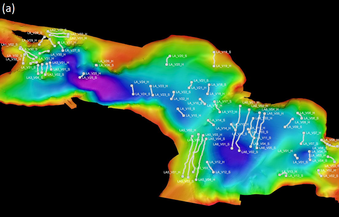
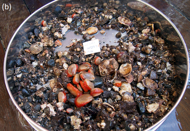
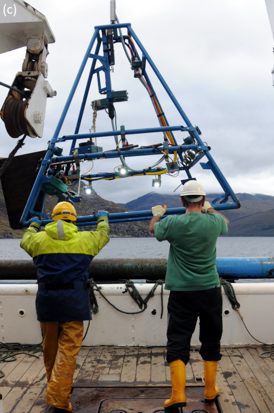
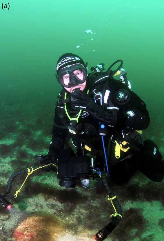
Scottish agencies have access to specialist research vessels suited to the spectrum of physical settings and utilise a wide range of complementary sampling techniques including remote video and stills cameras, grab and core sampling of sedimentary habitats (Figures 3b and c) and diving. These finer resolution methods may be combined with broader coverage Earth observations such as multibeam acoustic mapping (Figure 3a) and aerial or satellite remote sensing in shallower coastal areas (see the Biogenic habitats assessment in relation to charting subtidal seagrass bed declines using aerial photography in the Sound of Barra). The duration of agency-led seabed habitat surveys undertaken from dedicated vessels generally enables the collection of greater numbers of records (average of 83 per survey in the period 2011 - 2018) and the coverage of larger areas away from the coast compared with citizen science studies.
Citizen science
Citizen science continues to make an important contribution to the knowledge-base; 224 of the 371 new surveys completed since 2011 were undertaken by Seasearch divers. These surveys account for 3,835 of the seabed habitat records collected in 2011 - 2018 (~25% of the total with an average of 17 records per survey). Data from nine other citizen science surveys undertaken in this period are available in Marine Recorder; three run by the Porcupine Marine Natural History Society; two collaborative surveys where NatureScot worked with the Scottish Wildlife Trust in 2015 and the Skye and Wester Ross Fisheries Trust in 2018; one Shore Thing intertidal survey; a Sea Change survey in the Wester Ross MPA in 2016 where the data collected was analysed through a NatureScot contract; and, eight records from two discrete surveys registered by individual, professional marine biologists. Collectively, these generated 268 habitat records.
Citizen science observations account for approximately 8.8% of all records of seabed habitats and species PMFs in Scottish territorial waters. Due to the coastal focus of most citizen science activity (largely constrained by access concentrating effort in the intertidal area and the shallow subtidal when working from small boats), this proportion falls to 4.4% across Scottish waters as a whole (e.g. when offshore and deep sea habitat PMF records are included in the calculations).
Seasearch is a UK and Ireland-wide marine citizen science initiative established in the mid-1980s that raises awareness of biodiversity and conservation issues amongst the diving community and provides an opportunity for participants to learn more about the wildlife and habitats they see underwater. This is achieved through a progressive training system, the publication of identification guides, and knowledge transfer from experienced participants, many of whom have a professional level of identification and survey skills (Wood et al., 2014). Seasearch volunteers record the species and habitats they see on standardised recording forms in accordance with training and supporting guidance. The forms are validated and verified by regional coordinators, who have first-hand knowledge of their local marine environment and the skill level of the recorders. The data are then entered into the Marine Recorder database and additional QA checks are made by the National Seasearch Coordinator before the data are supplied to the statutory conservation agencies and made publicly available via NBN Atlas.
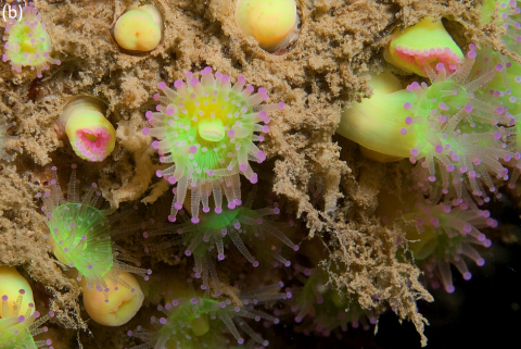
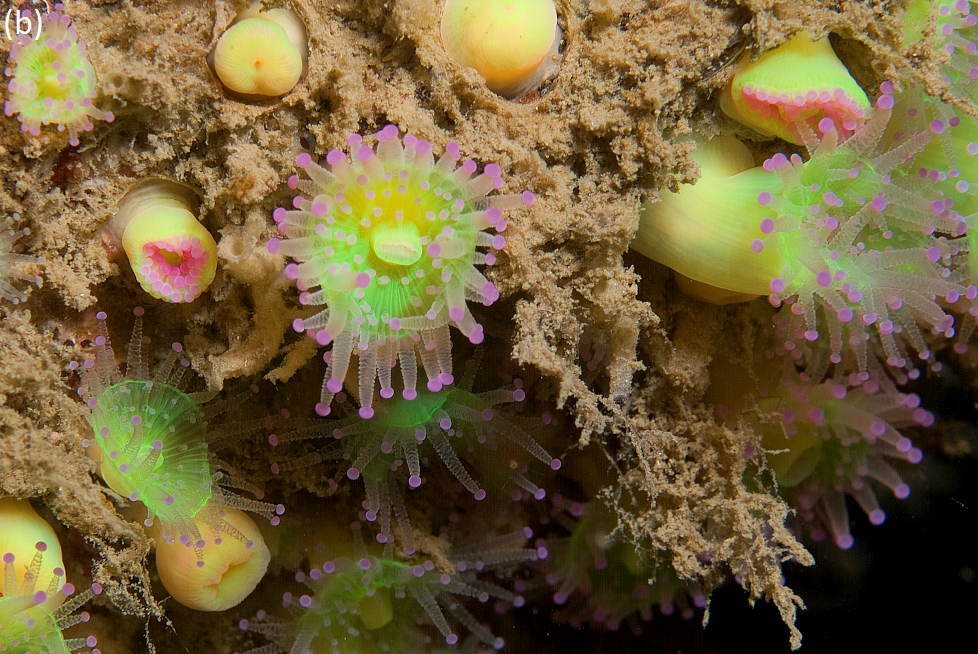
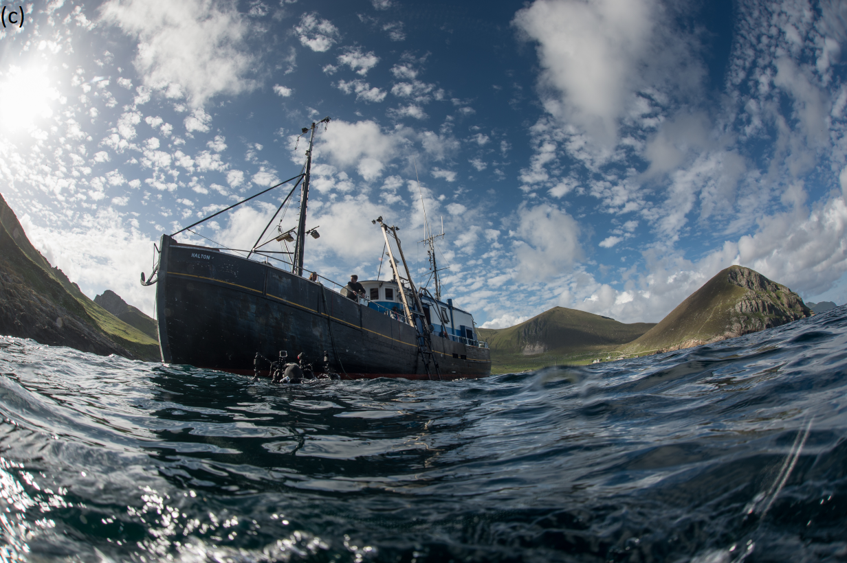
Seasearch surveys are organised by local coordinators and vary in scope from single day shore diving and snorkelling visits to week long trips on liveaboard hard boats. The diving focus constrains sampling to water depths less than approximately 30 m which is reflected in the coastal distribution of records (illustrated in Figures 2 and 5). And, with volunteers paying for their diving expeditions it is not unusual for more scenic locations to attract regular observations (see Figures 4a-c). This ensures that a number of Scottish MPAs get a periodic health check between formal monitoring events (e.g. at Berwickshire and Northumberland Coast SAC) including more remote locations (e.g. North Rona, Sula Sgeir, St Kilda & Fair Isle).
The marine conservation role of Seasearch was demonstrated in 2017 when divers reported on signs of damage to a flame shell bed, a sensitive seabed habitat PMF in outer Loch Carron (see also the Case study: Protecting the Loch Carron flame shell beds for more details). There were existing agency and citizen science records from a small bed further up the loch at North Strome, but the affected areas of habitat on the open coast were previously only known to local scallop divers. Follow-up survey work completed by NatureScot and Marine Scotland Science confirmed that legal fishing activity had been having an impact on two small beds in the outer part of the loch which led to the immediate introduction of precautionary fisheries management measures and ultimately the designation of an MPA. The 2017 survey work also confirmed the full extent of the bed in the adjacent Strome Narrows area. At approximately 2 km2 this is believed to be the largest known flame shell bed in the world (Moore et al., 2018).
![Changes in the knowledge-base in Loch Carron on the west coast of Scotland during 2011 - 2018. © Crown copyright [and database rights] 2020 OS 100017908.](https://marine.gov.scot/sma/sites/default/files/sma2020_-_seabed_habitats_-_figure_5_-_loch_carron.png)
Figure 5: Changes in the knowledge-base in Loch Carron on the west coast of Scotland during 2011-2018. Seabed habitat survey records before the 22 April 2017 (upper map) showing the indicative extent of a previously unreported flame shell bed in the outer part of the loch where Seasearch divers observed damage from towed, bottom-contacting fishing activity. Additional seabed habitat records in Loch Carron after the 22 April 2017 (lower map) showing the scope of subsequent Government agency survey work that led to the identification of the largest known flame shell bed in the world in the Strome Narrows in 2017. This bed was not affected by the fishing activity that damaged two of the three discrete, smaller beds mapped in the outer loch © Crown [and database rights] 2020 OS 100017908.
Capacity building
The Scottish MPA Monitoring Strategy recognises the significant contribution of existing citizen science initiatives (including numerous long-term studies of marine birds and mammals) noting that ‘supporting current and future citizen science programmes will be essential to maximise the information available for assessment and reporting’ (Marine Scotland, 2017).
NatureScot will continue to support Seasearch. To further harness enthusiasm and build capacity, NatureScot has also been working with Fauna & Flora International (FFI) (Figure 6), communities, local groups and individuals on a Community-led Marine Biodiversity Monitoring Project. The project has funding support from the William Grant Foundation (WGF) and is looking at practical ways to support and engage communities, local groups and those who use the sea for work or recreation, in marine survey and monitoring. This initiative has the potential to increase both the volume and types of data collected from a broader range of sampling techniques.
The initial phase started in October 2018 with a one year graduate placement (as part of Scotland’s Year of Young People programme) and the development of a ‘how to’ guide - a marine biodiversity monitoring handbook. The handbook was published in June 2020 (NatureScot et al., 2020) and with support from WGF a project officer is now in place until 2021 to facilitate the delivery of new surveys.
NatureScot launched online training to accompany the publication of the handbook, allowing people to learn more about different habitats and species and improve their survey skills by analysing underwater video footage from a variety of locations around Scotland (see https://www.nature.scot/sofa-seabed-virtual-training-explore-marine-life). A limited number of grants of up to £1,500 are also available over the lifetime of the project to enable groups to buy equipment ranging from species identification guides to underwater cameras.
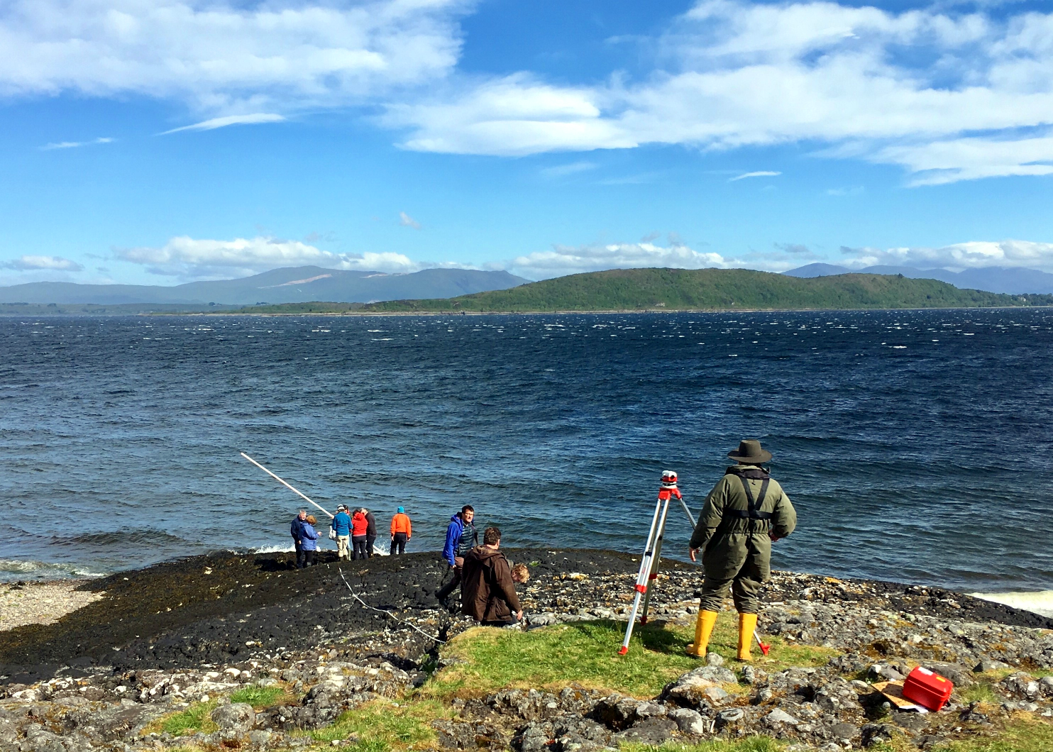
Figure 6: Community group completing a survey of a rocky shore at Dunstaffnage, Oban. © Cecilie Dohm, Fauna & Flora International.
Looking forward
Understanding of seabed habitats has improved considerably since Scotland’s Marine Atlas was published in 2011. This is an ongoing process and over the next marine plan reporting period, the results of seabed habitat survey work will continue to be used to explore areas currently considered to be gaps in the knowledge-base (see Figure 7), as well as charting the health of the protected features of MPAs and determining the effectiveness of new management measures. Work will be targeted to better inform evolving indicators such as that trialled in the new Biogenic habitats assessment. Stewardship and engagement will continue to be fostered through providing opportunities for others to be involved in surveying local coastal areas and discovering more about Scotland’s unique marine environment. Plans are in development to build on previous collaborations with academic institutes and industry through bigger partnership projects that recognise wider environmental net positive benefits for biodiversity, ensuring that robust data infrastructure is in place to secure longer-term data flows and the availability of marine survey data to all.
Work is also continuing with partners across the North-east Atlantic to maximise the biodiversity information and data from survey work undertaken for other purposes e.g. through developing methods to obtain seabed habitat information from routine fisheries stock assessment work and also information gathered in relation to other marine activities.
Collectively, this information and data will improve the ability to assess the status of seabed habitats in territorial waters and, where relevant, to identify the need for management measures to help protect and enhance Scotland’s marine environment.
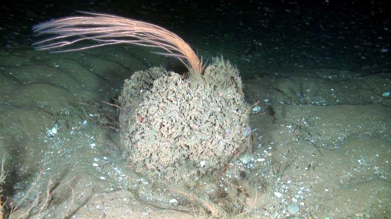
Figure 7: A screengrab from remotely operated vehicle (ROV) footage collected by Oceana, a nonprofit ocean conservation organization, during a research cruise off Fraserburgh in 2017 showing an aggregation of Sabellaria spinulosa on an otherwise relatively featureless fine sedimentary habitat. The ROV footage was kindly supplied by Oceana for inclusion in a MSS study to determine the status of S.spinulosa habitats off the Moray Firth and Aberdeenshire coasts (Pearce & Kimber, 2020) that will inform future nature conservation action. © Oceana.
Useful links
http://www.seasearch.org.uk/downloads/Seasearch-Quality-Assurance-Dec2018.pdf - a document outlining the Seasearch’s quality assurance procedures.
https://www.nature.scot/communitymarinesurvey - NatureScot web pages with details of the community-led marine biodiversity monitoring in Scotland.
https://www.flickr.com/photos/naturescot/ - NatureScot Flickr pages with lots of freely available marine survey (and other Scottish biodiversity) photos.
Scotland has an extensive and varied coastline comprising approximately 50% rocky and 50% sedimentary intertidal habitat. Large stretches of the Mainland west coast and Northern Isles are predominantly rocky whereas on the west coast of the Outer Hebrides and the Mainland east coast it is much more patchy with rocky shores and cliffs interspersed by large stretches of sandy and muddy coastline. Intertidal habitats are affected by numerous physical variables including wave exposure, salinity, temperature and tides which dictate what animals and plants are found on specific shores. The subtidal communities are strongly affected by factors such as the availability of light, wave action, tidal stream strength and salinity. Rocky shallow continental shelf habitats are typically dominated by seaweeds and in deeper areas below the photic zone (about 50 m) communities comprise exclusively animals. Shallow subtidal sediments in places support habitats such as seagrass beds and maerl, a red seaweed with a hard chalky skeleton that forms small twig-like nodules which accumulate to form loosely interlocking beds, creating the ideal habitat for a diverse community of organisms. Typically sedimentary habitats are dominated by a range of burrowing animal species.
The Biogenic habitats assessment catalogues the loss in extent of six biogenic habitats (all Priority Marine Features): blue mussel, horse mussel, flame shell, maerl, seagrass beds, and serpulid aggregations. The Predicted extent of physical disturbance to seafloor assessment uses the degree of exposure to demersal fishing activity as a proxy for habitat condition. The Intertidal seagrass assessment is a first attempt to understand the ecological health of Scottish intertidal seagrass and is restricted to six sites.
The Case study: Biogenic habitat enhancement highlights the efforts now being made to enhance the status of some biogenic habitats through activities aimed at aiding their recovery and restoration. In other cases, where damage to Priority Marine Features has occurred, positive action is taken as demonstrated in the Case study: Protecting the Loch Carron flame shell beds where emergency measures were put in place to prevent further damage and subsequently a Marine protected Area was designated. The fact the prevention is better than cure is illustrated by the Case study: Persistent damage to the Loch Creran serpulid reefs where damage that was first observed in 1998 still shows little evidence of recovery. The value of long-term monitoring of specific sites is illustrated by the Case study: Intertidal rock which highlights how looking at changes at a community scale helps separate natural variations on species abundances from longer term community trends. The growing awareness of natural capital and ecosystem services provided by the marine environment is illustrated by the three case studies Case study: Blue carbon in Scottish maerl beds; Case study: Blue carbon in Scottish marine sedimentary environments; Case study: Blue carbon: the contribution from seaweed detritus which highlight the importance of marine habitats in climate change mitigation through the capture and storage of blue carbon, and the need for the protection of such habitats from various anthropogenic activities. Despite a long history of intertidal and subtidal survey work there remains significant gaps in knowledge. The Case study: Seabed habitats in territorial waters - the evolving knowledge-base charts the ongoing surveys that have been undertaken by government agencies and citizen science initiatives to further expand and improve the knowledge base.