


Location and physical characteristics

Figure 1: Clyde Scottish Marine Region with the Solway (S.) to the south and Argyll (A.) to the north. The thicker white line delineates the extent of the Clyde SMR.
To see a map of all SMRs and OMRs click here
|
Sea area (km2):
|
4,279
|
|
Deepest point (m):
|
198
|
|
Shallowest point (m):
|
0
|
|
Average depth (m):
|
58
|
|
Tides (m):
|
0.85 – 3.08
|
|
Salinity:
|
32.90 – 33.63
|
|
SST:
|
7.88 – 14.52
|
The Clyde SMR (Figure 1) includes the Clyde Estuary (the area of the SMR where the Clyde river mouth meets tidal waters), four additional estuaries, the eight Clyde sea lochs, including Loch Fyne and Loch Long, and the Firth of Clyde (the shallow sea area where the freshwater influence is still evident, also referred to as the Clyde Sea). The Clyde SMR extends into the North Channel.
The Firth of Clyde is wide (Figure 1) with an outer sill (depth 40-50 m) that limits the water exchange with the more open sea. The Clyde Estuary, one of the major Scottish estuaries, has a large freshwater input and a large catchment area (from the river Clyde and Loch Lomond). Salinities in the more inshore areas differ considerably from those in the Firth of Clyde. The Clyde SMR exhibits the lowest salinities of all SMRs. The freshwater input dominates changes in salinity in the Firth of Clyde and adjacent coastal waters of the Clyde SMR, flowing around the Mull of Kintyre. Strong tidal currents exist around the Mull of Kintyre, where the topography constrains the flow; otherwise tidal currents are generally weak. Due to the large freshwater input, most of the Clyde SMR has strong vertical stratification. In coastal areas with large land run-off, such as from the river Clyde, turbidity is higher than those with coastal areas with smaller inputs or further offshore.
The Clyde SMR includes numerous islands, including Arran, Bute and the Cumbraes. Landscapes and seascapes range from the wide sandy beaches on the Ayrshire coast, and the mudflats and saltmarshes of the industrialised Clyde estuary near Glasgow, to the deep sea lochs of Argyll.
The diverse nature of the area is largely due to its geology and the effects of glaciation during the last ice age. The Highland Boundary Fault runs south west / north east through the Clyde SMR and evidence of this can be seen on shore in many places including at Helensburgh, across Bute and at Lochranza on Arran. The sea bed consists of Lower Palaeozoic rocks (500-400 million years old) to the south of the Southern Uplands Fault and to a limited extent in the Midland Valley, which is mostly formed of sediments and igneous rocks of Devonian and Carboniferous age (408-286 million years). To the north of the Highland Boundary Fault the rocks are mainly of the Dalradian Supergroup, largely Precambrian in age (>540 million years old). The intrusion of volcanic material during the more recent Tertiary period (some 60 million years ago) has had a profound effect on the geology and the landscape, with the island of Arran having been the centre of volcanic activity.
The last glacial period, which reached its coldest about 18,000 years ago, resulted in the carving out of the deep rock basins of Kilbrannan Sound and south-east Arran (McIntyre, Fernandes and Turrell, 2012). Thick sediments of gravel and sand were deposited directly by the retreating ice and glacial meltwaters, reducing their depth by up to 80 m. These largely filled the valleys of the Clyde Estuary and the Garnock/Irvine estuary. Ever since the ice sheets first began receding around 18,000 years ago there has been a complex interplay between rising global sea level due to the melt, and upward rebound of south-west Scotland from the weight of the ice. This resulted in variation in the location of the shoreline as the level of both the sea and the land altered (McIntyre, Fernandes and Turrell, 2012). That in turn has dictated the location and nature of further infilling by marine and intertidal sediments over recent millennia. The sea bed is a complex and dynamic system, with the majority of the outer basin and inner Firth made up of muddy and locally sandy habitats.
Productive
The Clyde SMR provides an important contribution to the Scottish economy. Figure 2 highlights the key economic statistics for the various productive sectors for the period 2014 – 2018. In addition to that some examples of past and present economic activity include: The Clyde SMR has historically been an area dominated by ship building and heavy industry. In addition, there is significant naval activity in the Clyde with Her Majesty’s Naval Base Clyde, a submarine base on the eastern shore of Gare Loch in Argyll and Bute to the north of the Firth of Clyde, 40 km west of Glasgow (see military activity as
The Clyde SMR provides an important contribution to the Scottish economy. Figure 2 highlights the key economic statistics for the various productive sectors for the period 2014 – 2018. In addition to that some examples of past and present economic activity include:
The Clyde SMR has historically been an area dominated by ship building and heavy industry. In addition, there is significant naval activity in the Clyde with Her Majesty’s Naval Base Clyde, a submarine base on the eastern shore of Gare Loch in Argyll and Bute to the north of the Firth of Clyde, 40 km west of Glasgow (see military activity assessment)
Fishing, especially for Nephrops continues (see fisheries assessment). The Clyde Nephrops fishery contributes to what was the second most valuable fishery for Scottish vessels in 2018. At the same time, the sea lochs provide a prime location for salmon and shellfish production (see aquaculture assessment)
Recreation has a long history in the Clyde. Although the GVA (gross value added) for marine tourism in the Clyde SMR fell by 9% over a four year period (2014-2017), in 2017 marine leisure and tourism accounted for 7,200 jobs and had a GVA of £136 million (see marine tourism assessment)
The Productive Assessment had a focus on the period 2014 – 2018 and was undertaken on a sectoral basis. For a number of Sectors, including renewables, oil and gas, carbon capture and storage and aggregates, there was no activity within the Clyde SMR during the period 2014 – 2018. However, for many sectors, there were changes over the defined period (Figure 2).

Figure 2: Changes in the Clyde SMR by Sector. Although the period 2014 – 2018 inclusive has been used where possible, there are some entries when a slightly different time period has been used. Information on Atlantic salmon and mussel production for Clyde SMR has been merged with Argyll SMR to avoid disclosure.
Pressures from human activities
As part of SMA 2020, an assessment of the main pressures from human activities in each of the Scottish Marine Regions and Offshore Marine Regions was undertaken through a MASTS-led workshop. The process and outcomes are presented in detail in the Pressure from Activities section. Five main pressures identified for the Clyde SMR ordered as per the MASTS-led Pressure Assessment Workshop were:
| Priority [1] | Pressure (FeAST classification) [2] | Main healthy and biologically diverse components affected [3] | Main contributing FeAST activity /activities to pressure [4] | Associated productive assessments [5] |
|---|---|---|---|---|
| 1 | Removal of target species (including lethal) |
|
||
| 2 | Surface abrasion |
|
||
| 3 | Removal of non-target species (including lethal) |
|
||
| 4 | Underwater noise |
|
||
| 5 | Hydrocarbon & PAH contamination. (Includes those priority substances listed in Annex II of Directive 2008/105/EC). |
|
Clean and safe
The assessments cover eutrophication, hazardous substances, marine litter, noise and microbiology and algal toxins which have the potential to impact on habitats and species as well as being a consequence of human activity. Although sources of litter or contaminants may be local, there are cases when the source is some distance from the impacted area. The main findings for the Clyde SMR are:
Eutrophication
There is no evidence of eutrophication as a consequence of nutrient enrichment with nutrient inputs, winter nutrient concentrations and chlorophyll concentrations relatively stable There were noted issues with dissolved oxygen where concentrations at the sea bed were below the assessment threshold and there were localised low dissolved oxygen issues within the Inner Clyde estuary.
Hazardous substances
Hazardous Substances (polycyclic aromatic hydrocarbons (PAHs), polychlorinated biphenyls (PCBs), polybrominated diphenyl ethers (PBDEs) and heavy metals (Hg, Cd and Pb)) assessments in sediment and biota (fish and shellfish) were undertaken at the scale of the five Scottish biogeographic regions: Atlantic North-West Approaches, Irish Sea (Clyde and Solway), Minches and Western Scotland, Scottish Continental Shelf and Northern North Sea. Highest contaminant concentrations were in the Irish Sea (Clyde and Solway) biogeographic region, which includes the Clyde SMR with concentrations above background and in some cases at levels where adverse effects could occur. Of most concern were lead and mercury in sediments, and the most toxic PCB compound (CB118) in sediment and biota, with the Irish Sea (Clyde and Solway) biogeographic region mean concentrations being unacceptable (> Effects Range Low for metals or > Environmental Assessment Criteria for CB118). However, concentrations in sediment and biota were generally stable or declining for all hazardous substances measured. Metal inputs were also high in the Clyde SMR but stable. At the local scale there is an issue with elevated water concentrations of Chromium VI in the inner Clyde estuary that is related to legacy industrial activity.
A number of biological effects were also measured and assessments undertaken at the scale of the five Scottish biogeographic regions. The contaminant specific biological effects (PAH bile metabolites and 7- ethoxyresorufin O-deethylase (EROD) activity) were consistent with the hazardous substances assessments and indicated that fish in the Irish Sea (Clyde and Solway) biogeographic region had been exposed to contaminants. However, the external fish disease assessment, which is a general measure of fish health gave contradictory results to the hazardous substances assessments and showed that the fish health status in this biogeographic region was satisfactory. Although there is only a single site in the Clyde SMR with a reasonable amount of data (Holy Loch) and while the fish disease index was acceptable (< Environmental Assessment Criteria) there was an increasing trend in fish health.
Marine litter
Due to the lack of assessment criteria for marine litter, beach litter and microplastic, status assessments were not possible. However, litter and microplastics are present in all SMRs, including the Clyde. The Clyde SMR was amongst the most contaminated for microplastics, particularly at the head of Loch Long, and also had the second highest average beach litter loading in Scotland.
Seafloor litter was assessed at the scale of the biogeographic regions; the Clyde is included in the Irish Sea (Clyde and Solway) biogeographic region. The evidence indicates that there is no consistent trend in seafloor litter density between 2012 to 2018. However, some categories of beach litter were decreasing in the Clyde SMR (plastic bags and plastic bottles), although sanitary items were increasing.
Noise
There are limited noise data for the Clyde SMR; no continuous noise data have been collected and there are very little impulsive noise data. It is not possible to do a status assessment as there are no assessment criteria to say what levels of noise are harmful, and not enough years of data to carry out a trend assessment.
Microbiology
There are 14 bathing waters in the Clyde SMR that are assessed according to levels of Escherichia coli and intestinal enterococci. Of these, three were classified as Poor in the latest classification (2018).
Escherichia coli is monitored in shellfish as a proxy of the microbiological quality of the water from shellfish production areas. Classifications are awarded according to the Food Standards Scotland (FSS) Protocol for Classification and Management of Escherichia coli. A site can be designated A, B, C, A/B or B/C, with Class A products able to go direct for human consumption. In the Clyde SMR just over half of production areas were in the highest class (A, 53%), and no areas had prohibited levels of Escherichia coli.
A number of marine algal species produce biotoxins which, by accumulation in bivalve molluscs such as mussels and oysters, can cause human illness when these shellfish are eaten. Both biotoxins and phytoplankton are routinely monitored in classified shellfish production areas under Regulation (EU) 2017/625. Such monitoring takes place at several sites within the Clyde SMR. Concentrations of amnesic shellfish toxins above regulatory limit were found in the Clyde in 2016 in mussels and razor clams. The Clyde SMR is more affected by paralytic shellfish toxins (PSTs) generally during spring and by diarrhetic shellfish toxins (DSTs) mostly during summer. PST events led to the closure of several shellfish production areas between 2011 and 2016 with an exceptionally high concentration of PSTs in mussels (nearly 35 times above the regulation limit) recorded in April 2015. There were DST events every year between 2010 and 2018 leading to harvesting site closures, sometimes for extended periods of several months. Particularly dense blooms of Dinophysis (phytoplankton species associated with DST production) were observed between 2016 and 2018.
Healthy and biologically diverse
This section summarises the information from the Marine Protected Areas (MPAs) and intertidal and continental shelf habitats assessments from SMA2020. It also provides information from the relevant case studies relating to Priority Marine Features (PMFs), with a focus on habitats. Further work is required to enable assessment at a regional scale for most species; this will be included in Scotland’s next marine assessment.
At a regional scale for MPAs the focus is on the number of new MPAs, MPAs with new spatial management measures, and MPAs in which spatial management measures are in discussion, as well as recognising monitoring that has been undertaken between 2012-2018. For the marine habitats, the focus is on interpreting the relevant intertidal and continental shelf habitat assessments – biogenic habitats, predicted extent of physical disturbance to the seafloor (BH3) and intertidal seagrass beds. For PMFs, a summary is provided of the changes in our understanding of the habitats of most relevance to the SMR, including changes in distribution and extent.
Marine Protected Areas
Progress in developing the Scottish MPA network
There are 12 MPAs in the Clyde SMR that contribute to the Scottish MPA network (see Table 1). Some of these MPAs overlap completely or partially in terms of their spatial coverage and/or the features (habitats, species, etc.) they were set up to help conserve. They are counted as separate MPAs because they have been established under different legislation which influences the way in which they are managed. Also note that there are MPAs that straddle the boundaries between different SMRs/OMRs. Where this is the case, these MPAs have been counted as contributing to the MPA network in all of the SMRs/OMRs in which they are present. This means that the total number of MPAs in Scotland cannot be calculated through combining the SMR/OMR totals. Please see the Marine Protected Area assessment which contains statistics for the Scottish MPA network as a whole.
Table 1. Numbers of types of MPAs in the Clyde SMR that contribute to the Scottish MPA network, including the number of new MPAs introduced since 2012.
|
Type of MPA |
Abbr. |
Total no. of MPAs |
No. of new MPAs 2012-2018 |
|
Historic MPA |
HMPA |
1 |
1 |
|
Nature Conservation MPA |
MPA |
3 |
3 |
|
Ramsar |
- |
1 |
0 |
|
Site of Special Scientific Interest |
SSSI |
5 |
0 |
|
Special Protection Area |
SPA |
2 |
0 |
There are 12 MPAs in the Clyde SMR that have been designated for a broad range of features including intertidal and subtidal habitats and species, fronts, wintering waterbirds, and breeding seabirds.
There are three Nature Conservation MPAs in the Clyde SMR. The South Arran MPA includes features such as burrowed mud, kelp and seaweed communities on sublittoral sediments, maerl beds, maerl or coarse shell gravel with burrowing sea cucumbers, ocean quahog aggregations, seagrass beds and shallow tide-swept coarse sands with burrowing bivalves. The Upper Loch Fyne and Loch Goil MPA contains burrowed mud, including in Loch Shira, an arm of upper Loch Fyne that supports the densest known colonies of fireworks anemones (Pachycerianthus multiplicatus) in Scotland, and flame shell beds, horse mussel beds, sublittoral mud and specific mixed sediment and ocean quahog aggregations. The Clyde Sea Sill MPA is designated for the thermal front that concentrates nutrients and plankton creating feeding hotspots for fish which in turn attract other higher marine predators, such as black guillemot. The sill is of great importance to local fish stocks with existing fisheries management measures in place here for spawning cod. In addition, the various sedimentary habitats within these sites also contain significant carbon stores (i.e. blue carbon)
There are two SPAs within the Clyde SMR. The cliffs of Ailsa Craig support nesting populations of seabirds of European importance including one of the largest northern gannet colonies in the world as well as lesser black-backed gulls, common guillemot and black-legged kittiwakes. The Inner Clyde SPA supports a variety of migratory wintering waterbirds, in particular common redshank, which feed on the eelgrass, mussel beds and on the many invertebrates, such as worms and snails, living within the mudflats and saltmarsh.
Progress in managing MPAs
The progress in implementing management for MPAs in the Clyde SMR is summarised in Table 2. This includes information on where spatial management measures are in place and where they are under discussion. It also includes information on the number of MPAs that have been monitored, whether by statutory bodies or through citizen science.
Table 2. Summary of progress in managing Marine Protected Areas in the Clyde SMR
Note that the spatial measures listed in the table are in addition to the protection provided as a result of consideration of activities/developments through licensing and consenting processes. Also, the monitoring of birds and habitats within SSSIs has been split out to reflect the different programmes of work. These figures cannot be added together to provide a total number of SSSIs in which monitoring took place because of overlaps in coverage.
|
Type of MPA |
No. of MPAs with spatial measures in place pre-2012 |
No. of MPAs with new spatial measures in place 2012-2018 |
No of MPAs with spatial measures in discussion 2012-2018 |
No. of MPAs monitored by statutory bodies 2012-2018 |
No. of MPAs monitored by citizen scientists 2012-2018 |
||
|
Nature Conservation MPA |
0 |
2 |
1 |
3 |
2 |
||
|
Ramsar |
0 |
0 |
0 |
1 |
1 |
||
|
Site of Special Scientific Interest |
0 |
0 |
0 |
Birds |
1 |
Birds |
1 |
|
Habitats |
3 |
Habitats |
0 |
||||
|
Special Protection Area |
0 |
0 |
0 |
2 |
0 |
||
During this assessment period, an Inshore Fishing Order was put in place for Upper Loch Fyne and Loch Goil MPA and a Marine Conservation Order (MCO) for South Arran MPA. The MCO for South Arran MPA includes the Lamlash Bay No Take Zone which has been in place since 2008. The management measures for fishing activity in MPAs within the Clyde SMR mainly focus on restrictions relating to the use of demersal mobile gear. However, there are also static gear restrictions within South Arran MPA for the maerl beds because of their ‘recover’ conservation objective. Further measures are under discussion for Clyde Sea Sill MPA.
During this assessment period the majority of the MPAs have been monitored at least once by the statutory bodies, and some have had multiple visits. Monitoring has covered seabirds, wintering waterbirds, and intertidal and subtidal habitats. NatureScot has led on monitoring most of these MPAs, with input from Marine Scotland Science in South Arran MPA. Seabird monitoring at Ailsa Craig is carried out through a partnership between NatureScot and the Royal Society for the Protection of Birds.
Citizen science has contributed towards monitoring the South Arran MPA and Upper Loch Fyne and Loch Goil MPA. Numerous Seasearch surveys have taken place in both MPAs providing data on the presence of benthic habitats and species, such as fireworks anemone. The Community of Arran Seabed Trust (COAST), in partnership with universities, has carried out work including monitoring biodiversity and habitat quality in the Lamlash Bay No Take Zone and South Arran MPA. The Inner Clyde SSSI and Ramsar site are monitored through the British Trust for Ornithology’s Wetland Bird Survey citizen science project.
Information on MPA boundaries can be viewed in Marine Scotland’s NMPi. To find out more about specific MPAs, please visit NatureScot’s SiteLINK. Detailed reports on habitat monitoring are referenced in Further reading – seabed habitat monitoring reports.
Intertidal and continental shelf habitats
SMA2020 contains three relevant habitat assessments: intertidal seagrass beds; biogenic habitats; and predicted extent of physical disturbance to seafloor. The assessments consider the status and trend of six marine habitats within this SMR, comprising intertidal seagrass and the following subtidal biogenic habitats: blue mussel beds, horse mussel beds, seagrass beds, flame shell beds and maerl beds. Modelling work was carried out as part of the assessment to predict the extent of physical disturbance to the seafloor more generally.
Intertidal seagrass
Single baseline surveys of seagrass beds were carried out on four beds at two locations (outer Clyde estuary and Hunterston) in 2016 but as the status assessment methodology (Water Framework Directive seagrass tool - WFD-UKTAG, 2014) is dependent upon the analysis of a temporal series of data, no indication of status for the region, nor trend, could be derived for the period 2012 - 2018. These beds form part of an ongoing Water Framework Directive monitoring programme that will enable status assessments to be undertaken in future years.
Subtidal biogenic habitats
For the Clyde biogenic habitats as a whole the status category assigned for SMA2020 was ‘Some concerns’ on the basis of recorded reductions in habitat extent of flame shell and maerl beds.
The only flame shell bed to have been examined in the Clyde SMR during the SMA2020 assessment period is that at Otter Spit in Loch Fyne (Moore et al., 2013). This was thought to possibly represent the only remaining bed in the Clyde SMR, although a small bed of around 1 ha. was discovered off the south of Arran in 2020 (COAST, 2020). In 2012 the extent of the Otter Spit bed was estimated to be 50 ha (Moore et al., 2013).
Knowledge of the status of the Otter Spit bed has been enhanced by the establishment of a monitoring programme, for which a baseline survey was carried out by SNH in 2015. Elements of this have been published (Allen, 2017 - for infaunal data, Moore, 2019 - for dropdown video). The monitoring programme incorporates the establishment of permanent monitoring transects, which will facilitate future identification of trends in the status of the bed; however, despite the use of different methodologies some analysis of change over the period 2012 – 2015 is possible. There is a recorded change in bed extent from an estimated 50 ha in 2012 to 59 ha in 2015 (Figure 3) but as the recorded extension of the bed boundary was in areas that were not sampled by the 2012 survey, this is not evidence of real temporal change. In terms of bed condition there was no clear temporal pattern in the percentage cover of the seabed by the flame shell byssal turf (Figure 3). A comparison of the taxon richness of the faunal community associated with the habitat, derived from replicate core samples taken at one station in 2012 and at three stations in 2015 (in areas where flame shells were present in the cores) revealed a decrease in mean species richness per core from 57 in 2012 to 32 in 2015. However, the reduction was only significant between the 2012 station and one of the 2015 stations (ANOVA with Tukey multiple comparison test, P = 0.042) and is not conclusive. Possible explanations for the difference include the coarser sieve mesh used in the later survey (1.0 mm rather than 0.5 mm) and the low densities of flame shells at the 2015 station.

Figure 3. Flame shell turf cover, abundance records and estimates of bed distribution from surveys in 2012 and 2015 at Otter Spit, Loch Fyne.
In addition to the flame shell bed there are also historical records of a 17.5 ha maerl bed at Otter Spit, last recorded in 1999 (Hall-Spencer & Moore, 2000b). This was found to have disappeared by 2012 (Moore et al., 2013), representing around a 10% reduction in the known extent of the habitat in the Clyde SMR. The data indicate a decreasing trend in maerl bed status between 1999 and 2012. While this is no doubt true for the Otter Spit maerl bed, the confidence in extending this conclusion to the Clyde SMR as a whole is low, for the same reasons as those listed above for the flame shell habitat. As in the case of flame shell beds, scallop dredging has been implicated as a significant contributor to the decline of maerl beds in the Clyde SMR (Hall-Spencer & Moore, 2020b).
A 2018 video survey programme has resulted in a considerable expansion in the distribution of Clyde SMR maerl bed records (O’Dell et al., 2021) (Figure 4) although the analysis was not completed in time for inclusion in the SMA2020 assessment. The results highlight the poor condition of maerl habitats in the SMR. A total of 87 new records were generated, most of these ‘maerl bed’ records represent locations where no living maerl was found (50). Only sparse live maerl thalli were found at a further 32 sites. The remaining five were located within or adjacent to known maerl beds off Pladda Island, within the South Arran MPA. These results in combination with those obtained from re-analysis of dropdown video footage from a 2015 SNH survey (Moore, 2021) increases the estimated extent of the Pladda beds from 32 ha to 49 ha.
Unattached Phymatolithon calcareum maerl thalli in Scottish waters (the dominant species) are probably almost entirely vegetatively propagated (Birkett et al., 1998). With growth rates of the order of 1 mm yr-1 this indicates that recovery of damaged beds is likely to take decades, and significantly longer in the absence of live maerl material.
Although present in the SMR, the data for subtidal seagrass, blue and horse mussel beds were insufficient to derive assessments of status for SMA2020. Although habitat extent data are available for some of the subtidal seagrass beds south east and south of Arran, no temporal data have been collected. There are no data on the extent of the subtidal blue mussel bed habitat in the Clyde SMR. Beds have been recorded at three locations between 2012 and 2018 in upper Loch Long and Loch Goil (Figure 5) with records of abundant mussels at two of them. There are also no estimates of horse mussel bed extent in the region, although the habitat has been recorded at 18 locations (Figure 5). At six of these locations the abundance of horse mussels, is low (<1/m2 or <Common on the SACFOR semi-quantitative scale) and therefore these are not considered to be beds.

Figure 4. Temporal pattern of maerl bed records in the Clyde SMR.
Note that the majority of maerl records in this region contain no living maerl. A substantial proportion contain only sparse live maerl thalli.

Figure 5. Distribution of subtidal horse and blue mussel bed records in the Clyde SMR with mussel abundance.
Predicted physical disturbance to the seafloor
To assess physical disturbance to seafloor habitats SMA2020 employed a modelling approach which generates a map of predicted relative disturbance levels from demersal fishing activity on a scale of 0 (zero) to 9 (severe). The map was produced by the combination of information on the distribution of habitats, the sensitivity of the habitats (and species present to varying degrees) and the fishing pressure from demersal trawling, dredging and seine netting. Fishing pressure information was derived from Vessel Monitoring System (VMS) data from 2012 - 2016 and was categorised as either surface abrasion (disturbance of surface and upper layers of sediment) or sub-surface abrasion (disturbance to a depth of >3 cm). The final predicted disturbance index utilises the greater of these two pressure values and for descriptive purposes has been categorised as no disturbance (0), low disturbance (1-4) and high disturbance (5-9).
It should be emphasised that this method does not measure disturbance to seabed habitats, but predicts relative levels of disturbance. These relative levels are dependent upon the accuracy of habitat data and sensitivity assessments. A lot of the habitat data are derived from modelling and have a low level of confidence in their accuracy. Geographical variation in the accuracy of the sensitivity information employed is likely to be great, being dependent upon the level and quality of information used locally. A significant limitation of the method is that during the assessment period pressure data were only available for vessels >12 m, which has probably resulted in an underestimation of disturbance for the SMRs.
Predicted habitat disturbance for the Clyde SMR is amongst the highest, with 65% of the sea floor subject to high disturbance compared to an average of 50% for all SMRs and 8% with no disturbance (average of 12% for all SMRs) (Figure 6). Disturbance levels closely mirror the distribution of habitat and species sensitivities to sub-surface abrasion and are high throughout most of the Firth of Clyde, particularly in areas of mud in the southern half of the Firth. There is a marked reduction in predicted disturbance on the harder, sandier grounds at the mouth of the Firth. Most of the area now encompassed by the South Arran MPA displayed high levels of disturbance. The corresponding demersal fisheries prohibition within the MPA was enacted in 2016 and so will have had little effect on the assessment, which covered the period 2012 - 2016.

Figure 6. Predicted physical disturbance to the seafloor in the Clyde SMR and prohibition areas for all mobile demersal fishing. (Note that the prediction of physical disturbance covered the period 2012-2016 and so the fisheries prohibition relating to the South Arran MPA will have had little effect on this assessment.)
Priority Marine Features and birds (non-PMF)
Overview of recorded PMFs and birds
The Clyde SMR supports a range of PMFs and breeding seabirds as well as wintering waterbirds (i.e. waders, estuarine waterfowl, seaduck and coastal water feeding birds) as detailed in Table 3.
Table 3: Details of PMFs, seabirds, and wintering waterbirds found in the Clyde SMR
|
Priority Marine Features (PMFs; grouped habitats and species) and birds |
No. of species/ habitats recorded |
|
Intertidal and continental shelf habitats |
17 |
|
Fish[1] |
20 |
|
Mammals (regularly occurring) |
11 |
|
Shellfish & other invertebrates |
4 |
|
Seabirds[2] (non-PMF) – breeding |
19 |
|
Wintering waterbirds[3] (non-PMF) – non-breeding |
13 |
There are records of 52 PMFs occurring in the Clyde SMR with the second highest number of different intertidal and subtidal PMFs of any SMR. Of particular note are the sheltered reef and deep mud communities throughout the sea lochs in the northern part of the SMR and the tideswept reefs off the Mull of Kintyre and Pladda. It also contains the most southerly records of the northern sea fan and sponge communities in Scotland near the Isle of Bute. The SMR also contains extensive areas of deep burrowed mud within the Clyde basin and is also one of the few SMRs where sublittoral blue mussel beds occur.
There are 33 species of breeding seabirds and non-breeding wintering waterbirds recorded in the SMR including the most southerly established breeding colonies of Manx shearwater and storm petrel in Scotland on Sanda island as well as one of the largest northern gannet colonies in the world on Ailsa Craig. The extensive estuarine mudflats provide rich feeding grounds for various wintering waterbirds and in particular the common redshank.
Progress in understanding of intertidal and continental shelf habitats listed as PMFs
Over the last ten years there has been a change in emphasis of survey work in the region, with much of the earlier work by government agencies focused on obtaining an understanding of the distribution and conservation importance of habitats and species through detailed examinations of the sea lochs. Over the 2012 - 2018 assessment period the focus has turned to improving understanding of PMF distribution and to the identification and subsequent monitoring of MPAs, as well as building up a broad understanding of habitat distribution to guide MPA boundary setting and checking that implemented management measures are effective.
The temporal sequence of records of all PMF habitats is provided in Table 4, based on inclusion in the Marine Recorder (2021) and GeMS (2021) databases, as well as identified additional sources. Associated commentary, however, is restricted to PMFs for which the information has the potential to inform regional marine planning. For example, some PMFs are excluded on the basis that they are very widely distributed and for which the records represent a small proportion of their likely distribution, such as several of the kelp habitats.
Table 4. Temporal frequency of PMF records within the Clyde SMR obtained from GeMS (2021), Marine Recorder (2021) and other sources. The numbers of All records are given, as well as those from Citizen Science (CS) surveys alone.
|
PMF |
Year |
|||||
|
<2012 |
2012-2018 |
>2018 |
||||
|
|
All |
CS |
All |
CS |
All |
CS |
|
Blue mussel beds |
24 |
1 |
5 |
4 |
0 |
0 |
|
Burrowed mud |
324 |
5 |
163 |
20 |
14 |
14 |
|
Burrowed mud or Inshore deep mud with burrowing heart urchins |
475 |
3 |
33 |
13 |
4 |
4 |
|
Flame shell beds |
1 |
0 |
40 |
1 |
0 |
1 |
|
Horse mussel beds |
32 |
1 |
14 |
14 |
3 |
3 |
|
Inshore deep mud with burrowing heart urchins |
1 |
0 |
0 |
0 |
0 |
0 |
|
Intertidal mudflats |
6 |
0 |
6 |
0 |
0 |
0 |
|
Kelp and seaweed communities on sublittoral sediment |
224 |
28 |
206 |
56 |
6 |
6 |
|
Kelp beds |
16 |
14 |
16 |
11 |
1 |
1 |
|
Low or variable salinity habitats |
33 |
0 |
10 |
10 |
18 |
18 |
|
Maerl beds |
151 |
13 |
84 |
13 |
0 |
0 |
|
Maerl or coarse shell gravel with burrowing sea cucumbers |
2 |
0 |
18 |
1 |
0 |
0 |
|
Sea loch egg wrack beds |
0 |
0 |
1 |
1 |
0 |
0 |
|
Seagrass beds |
18 |
13 |
236 |
9 |
1 |
1 |
|
Tide-swept algal communities |
11 |
1 |
14 |
3 |
1 |
1 |
|
Tide-swept coarse sands with burrowing bivalves |
19 |
0 |
9 |
0 |
0 |
0 |
The table illustrates the increasing importance of citizen science records in raising the understanding of PMF distribution. The proportion of citizen science records has increased from 6% before 2012 to 23% in more recent years.
The following paragraphs outline the changes in understanding of the distribution of specific PMF habitats that have occurred since 2012 in the Clyde SMR. Detailed commentary relating to several of the biogenic habitats (seagrass, maerl, flame shell, horse mussel and blue mussel beds) is provided in the section on Intertidal and continental shelf habitats but they are summarised here.
The major progress in recent years in subtidal seagrass knowledge for the SMR relates to the 2014 mapping of an extensive bed in Whiting Bay, South Arran (66 ha), which accounts for many of the post-2011 records. The largest known intertidal seagrass beds in the SMR in the outer Clyde estuary (11 ha) and at Hunterston (19 ha) were also mapped in 2016 and new beds located along the south coast of Arran in 2012 (1 ha). All known subtidal blue mussel beds were identified at three locations between 2012 and 2018 in upper Loch Long and Loch Goil. By contrast, 24 intertidal blue mussel beds were recorded prior to 2012 in the upper lochs of the SMR, with a single post-2012 record for Irvine, Ayrshire. Horse mussel beds have been recorded at 18 locations, with the majority of records located in the upper loch system between 2012 and 2019. The only pre-2012 flame shell bed record in the GeMS (2021) and Marine Recorder (2021) databases is for Otter Spit in Loch Fyne. 2012 and 2015 surveys have considerably expanded knowledge of the distribution of the Otter Spit bed and a new bed was identified off Arran in 2020. Knowledge of the distribution of maerl beds throughout the SMR has been much improved since 2012, particularly resulting from a 2018 survey of the SMR.
There has been considerable expansion of the known distribution of burrowed mud over the period 2012 – 2018, with the great majority of historical records confined to the northern lochs of the SMR (Figure 7). It is now known to be also widely distributed in lower Loch Fyne and the Firth of Clyde and so extends considerably beyond the coverage as represented by the distributional polygons in the GeMS database. Knowledge of the probable distribution of the habitat is also available from annual Nephrops burrow density surveys carried out by Marine Scotland from 2007 - 2016. While Nephrops is also associated with several other habitat types, these data indicate that burrowed mud is likely to have covered much of the sea bed of the Firth of Clyde throughout that period.

Figure 7. Temporal pattern of records of selected burrowed mud PMF habitat and species components for the Clyde SMR, as well as mean Nephrops burrow densities from Marine Scotland monitoring surveys.
Valid burrowed mud records have largely been referred to the PMF component biotope SS.SMu.CFiMu.SpnMeg, although SS.SMu.CFiMu.MegMax has been widely reported from the upper loch system (Figure 7). The only records for the component biotope SS.SMu.CFiMu.SpnMeg.Fun are derived from 2016 Seasearch surveys at three locations at the head of Loch Fyne, although the presence of the characterising seapen Funiculina quadrangularis is unrecorded here in both the GeMS and Marine Recorder databases. However, the species has been widely reported in the Firth of Clyde during Marine Scotland Nephrops surveys between 2008 and 2010, but at very low density (Figure 7). The low population density may explain why there have been no records of the SS.SMu.CFiMu.SpnMeg.Fun biotope in the Firth. Funiculina quadrangularis has been regarded as being highly intolerant of abrasion and physical disturbance (Ager, 2003) and so localised reduction in the historically high fishing pressure in the Firth (see Figure 6 and related text) as a result of the 2016 demersal fishery prohibition order for the South Arran MPA may favour future development of the biotope.
Early records of low or variable salinity habitats were principally restricted to Lochs Riddon, Striven, Long and Goil, almost all in the form of ‘kelp in variable or reduced salinity’ (IR.LIR.KVS.LsacPsaVS) (Figure 8). Seasearch surveys from 2016-2019 have significantly extended knowledge of the distribution of the PMF, particularly in Loch Fyne and upper Loch Long, although the principal component PMF recorded has been ‘submerged fucoids, green or red seaweeds (low salinity infralittoral rock)’ (IR.LIR.Lag).
Pre-2012 records of tide-swept algal communities were largely restricted to the PMF component ‘kelp and seaweed communities in tide-swept sheltered conditions’ (particularly IR.MIR.KT.XKTX) in the Kyles of Bute (Figure 8), but subsequent surveys in more exposed locations around the southern coast of Arran and Little Cumbrae Island have revealed the widespread occurrence of kelp forests and parks belonging to another PMF component ‘Laminaria hyperborea on tide-swept infralittoral mixed substrata’ (IR.MIR.KR.LhypTX).
The distribution of the PMF ‘Maerl or coarse shell gravel with burrowing sea cucumbers’ (SS.SCS.CCS.Nmix) was little known prior to 2012, but as a result of survey work performed from 2012 to 2018 in relation to the establishment of the South Arran MPA, the habitat has been found to occupy a fragmented belt around the south coast of the island (Figure 8). The estimated extent of the habitat derived from 2012 – 2014 records is 1,459 ha (GeMS, 2021), and this coverage has not been extended by subsequent records. However, this may be a marked underestimation of its distribution as its identification is dependent upon observation of the characterising sea cucumber, Neopentadactyla mixta. The relatively low density of this species, combined with its ability to withdraw deeply into the sediment, result in inefficiency in recording its presence by either grab or observational methods.
A small pocket of the PMF ‘Tide-swept coarse sands with burrowing bivalves’ (SS.SCS.ICS.MoeVen) was identified in Lamlash Bay in 2010 (Munro et al., 2014) and its distribution mapped at 30 ha (GeMS, 2021). An SNH grab survey in 2012 extended its known distribution to the southern Arran coast (Allen, 2013). However, many of the records from both these surveys were uncertain and so the distribution of this habitat within the SMR remains poorly understood.
There is a single record of a sea loch egg wrack bed in the SMR, identified from a 2015 Seasearch survey in East Loch Tarbert (Figure 8). This represents the southernmost known bed in Scotland.

Figure 8. Temporal pattern of records of selected PMF habitats for the Clyde SMR.
Public availability of detailed information relating to the location of native oyster records is considered prejudicial to the conservation of the species and so published versions of the GeMS and Marine Recorder databases provide limited information in this respect. The first record of a native oyster bed in the SMR was in the lower Loch Fyne area in 2018 (GeMS, 2021), although it is possible that Great Cumbrae Island supported a bed in the 19th century (Moore, 2019). However, the species, Ostrea edulis, has been reported from at least four locations in the SMR (Marine Recorder, 2021 - unredacted version), with post-2011 records adding two locations to its known distribution. There are also anecdotal reports of small pockets of the species in Loch Riddon and Loch Striven (Moore, 2019).
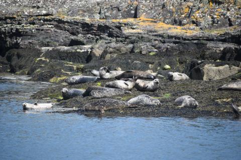
Status and trend in grey and harbour seals
The Clyde SMR is included in the Southwest Scotland seal management area (that encompasses the Clyde and Solway SMRs) and as such there are not specific assessments of the status and trend in grey and harbour seals in this SMR. Within the combined Clyde and Solway SMRs there are relatively small numbers of both grey and harbour seals that are stable and the status of both species is assessed as ‘few or no concerns’.
Climate change
Sea surface temperature in the Clyde region has increased since 1870 by 0.04 °C per decade on average. The rate of increase has not been constant, and in the last 30 years (1988-2017), there was no statistically significant trend observed.
Tide gauge records from around Scotland’s coast show a high degree of year-to-year change in coastal water levels (typically several centimetres). The long-term average mean sea level change in the Clyde region, as estimated from a historical climate model run (UKCP18), was 4 cm (likely range between 1 and 7 cm) higher in 2018 than the 1981-2000 average. For reference, the Scottish average is estimated to be 5 cm (likely range between 3 and 8 cm). By 2100, mean sea-level rise in the Clyde SMR is anticipated to be approximately 33 cm for a medium emissions scenario (UKCP18 RCP4.5; see also and Climate change Sea level assessment).
Detecting and understanding long-term change in biological time series is complex, and resolving that which is due to climate change remains a challenge. Data from the Clyde SMR are limited in length of time series (only 2010-2017) and too short to robustly investigate a relationship with climate change (see Plankton Assessment).
Summary
The Clyde SMR has seen a 44% decrease in freight tonnage over the five years from 2014-2018 and a 5% increase in passenger numbers over the same period whilst the GVA for marine tourism decreased by 9% in the four years from 2014-2017. Over the five year period 2014-2018 in the Argyll and Clyde SMRs Atlantic salmon production increased by 41% and mussel production decreased by 48% and in the Clyde SMR Pacific oyster production decreased by 20%. Rod and line salmon and sea trout catch weight decreased by 25% over the five years between 2014-2018. An estimated 300 wet tonnes of seaweed were harvested annually. The value of fish catch decreased by 9% over the five years between 2014-2018. Other active sectors include military activities, water abstraction historic environment and cultural heritage, waste disposal, coastal erosion and flood risk management and subsea cables.
The five main pressures affecting the SMR are Removal of target species, Surface abrasion, Removal of non-target species, Underwater noise and Hydrocarbon and PAH contamination. Other pressures identified are Deoxygenation, Death or injury by collision below water, Genetic modification and translocation of indigenous species, Introduction of microbial pathogens, Introduction and spread of non-indigenous species, Nitrogen and phosphorous enrichment, Organic enrichment, Physical change, Physical loss, Physical removal, Siltation rate changes – heavy and light, Sub-surface abrasion/penetration, Synthetic compound contamination, Visual disturbance and Water clarity changes.
There is no evidence of eutrophication as a consequence of nutrient enrichment in this SMR but there were noted issues with dissolved oxygen concentrations below the assessment threshold in the Inner Clyde estuary. Contaminant (i.e. PAHs, PCBs, PBDEs and heavy metals) concentrations are generally above background and in some places at levels that might cause adverse biological effects. Most concern about lead and mercury in sediment, and the PCB compound CB118 concentrations in sediment and biota at some sites were unacceptable but showing a stable or declining trend. Litter and microplastics are present and microplastic contamination is amongst the highest of anywhere particularly at the head of Loch Long. Beach litter was also amongst the highest with some categories decreasing but others increasing. There are few noise data, and it was not possible to do an assessment. Three of the 14 bathing waters in the SMR assessed were classified as poor. Concentrations of diarrhetic shellfish toxins exceeded regulatory levels in every year between 2010 and 2018 leading to harvesting site closures, paralytic shellfish toxins concentrations in mussels resulted in site closures between 2011-2016. Blooms of Dinophysis were observed in 2016 and 2018.
Four new MPAs were designated between 2012-2018, and two new spatial management measures were put in place. Spatial management was under discussion for a further one. Subtidal biogenic habitats were assessed as ‘some concerns’, with 65% of the seafloor predicted to have been subject to high physical disturbance and 8% subject to none. There have been significant improvements in the knowledge of several seabed habitats including seagrass beds, kelp and seaweed communities on sublittoral sediment, burrowed mud and maerl beds, with citizen science records making an increasing contribution.
In the last 30 years there was no statistically significant trend in sea temperature rise. Sea level in 2018 is estimated 4 cm higher than the 1981-2000 average.
Lorem ipsum dolor sit amet, consectetur adipiscing elit. Vivamus fringilla quam lacinia arcu ullamcorper, eu porta nunc imperdiet. Nunc nibh sem, tristique ac volutpat et, commodo vel ligula. Cras cursus, nulla hendrerit sollicitudin rutrum, orci lorem rhoncus ex, quis pretium augue risus et enim. Donec consectetur nulla ac erat egestas porttitor. Nullam hendrerit rhoncus elementum. Maecenas in felis massa. Donec suscipit nibh at magna porta luctus.
In molestie mollis sollicitudin. Cras et dapibus velit, vitae blandit magna. In malesuada ac sapien at eleifend. Praesent interdum neque et lacus viverra gravida. Suspendisse potenti. Praesent sapien ex, ultricies porta dolor vitae, cursus imperdiet risus. Suspendisse lorem mi, tincidunt non nisl ac, faucibus accumsan odio. In id diam a leo rutrum aliquet a quis quam. Interdum et malesuada fames ac ante ipsum primis in faucibus. In laoreet erat nec nulla porttitor tristique. Nam nec ornare lorem. Nullam ultricies ex sed tincidunt venenatis. Mauris aliquam eleifend diam vitae hendrerit. Nullam euismod, eros vel sollicitudin dignissim, elit diam aliquam arcu, nec cursus sapien metus vel eros. Fusce tristique dolor ac ante fringilla mattis.
Lorem ipsum dolor sit amet, consectetur adipiscing elit. Vivamus fringilla quam lacinia arcu ullamcorper, eu porta nunc imperdiet. Nunc nibh sem, tristique ac volutpat et, commodo vel ligula. Cras cursus, nulla hendrerit sollicitudin rutrum, orci lorem rhoncus ex, quis pretium augue risus et enim. Donec consectetur nulla ac erat egestas porttitor. Nullam hendrerit rhoncus elementum. Maecenas in felis massa. Donec suscipit nibh at magna porta luctus.